
IMAGES TAKEN NEAR TO
Hague Close, LOWESTOFT, NR33 8UU
Introduction
This page details the photographs taken nearby to Hague Close, NR33 8UU by members of the Geograph project.
The Geograph project started in 2005 with the aim of publishing, organising and preserving representative images for every square kilometre of Great Britain, Ireland and the Isle of Man.

There are currently over 7.5m images from over14,400 individuals and you can help contribute to the project by visiting https://www.geograph.org.uk
Image Map
Images are licensed for reuse under creativecommons.org/licenses/by-sa/2.0
Notes
- Clicking on the map will re-center to the selected point.
- The higher the marker number, the further away the image location is from the centre of the postcode.
Image Listing (52 Images Found)
Images are licensed for reuse under creativecommons.org/licenses/by-sa/2.0
Image
Details
Distance
2
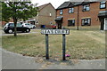
Lea's Drift, Oulton Broad street sign
It raises the question, who was Lea?
Image: © Adrian S Pye
Taken: 30 Jul 2022
0.03 miles
3
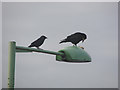
Table lamp
A jackdaw looks on as a rook uses the street lamp as a table to deal with a round of bread.
Image: © Adrian S Pye
Taken: 12 Oct 2010
0.03 miles
4
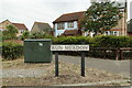
Run Meadow, Oulton Broad street sign
The derivation of the name is unknown to me
Image: © Adrian S Pye
Taken: 30 Jul 2022
0.04 miles

6
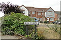
Rio Close, Oulton Broad street sign
Not all that close to any river that I know of, but the reason for the name is unknown, if indeed there is one.
Image: © Adrian S Pye
Taken: 30 Jul 2022
0.05 miles
7
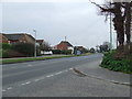
Road Junction
Road junction of Burnt Hill land onto the A.146 near to Oulton Broad, Suffolk.
Image: © Keith Evans
Taken: 23 Mar 2016
0.06 miles
8
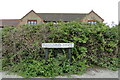
Pollard Piece, Oulton Broad street sign
Image: © Adrian S Pye
Taken: 30 Jul 2022
0.07 miles
9
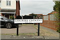
Chaulker's Crescent, Oulton Broad street sign
Named in honour of Lynda Chaulker (MP, 1989 to 1997)
Image: © Adrian S Pye
Taken: 30 Jul 2022
0.07 miles
10
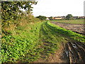
Footpath from Burnt Hill Lane to Beccles Road
Image: © Evelyn Simak
Taken: 11 Oct 2010
0.07 miles