
IMAGES TAKEN NEAR TO
Gondree, LOWESTOFT, NR33 8UE
Introduction
This page details the photographs taken nearby to Gondree, NR33 8UE by members of the Geograph project.
The Geograph project started in 2005 with the aim of publishing, organising and preserving representative images for every square kilometre of Great Britain, Ireland and the Isle of Man.

There are currently over 7.5m images from over14,400 individuals and you can help contribute to the project by visiting https://www.geograph.org.uk
Image Map
Images are licensed for reuse under creativecommons.org/licenses/by-sa/2.0
Notes
- Clicking on the map will re-center to the selected point.
- The higher the marker number, the further away the image location is from the centre of the postcode.
Image Listing (19 Images Found)
Images are licensed for reuse under creativecommons.org/licenses/by-sa/2.0
Image
Details
Distance
1
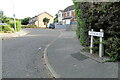
Gondree, (Normandy landings)
The Gondree family in the cafe by the Pegasus bridge were the first family to be liberated on June 6th 1944. Image
Image: © Adrian S Pye
Taken: 8 Jul 2022
0.04 miles
2
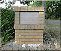
Normandy landings memorial plaque
Roads in the proximity of this plaque are named after the villages and people liberated after the Normandy landings June 6th 1944.
See for a close-up
Image: © Adrian S Pye
Taken: 8 Jul 2022
0.05 miles
3
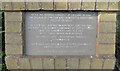
Normandy landings memorial plaque
Roads in the proximity of this plaque are named after the villages and people liberated after the Normandy landings June 6th 1944. It reads:
"After the Norman Conquest of England in 1066 the village of Carlton was granted the additional title of Colville"
In the D-Day landings in Normandy, June 6th 1944 the first French family liberated were the Gondree's (sic) living in a cafe by the canal bridge in Bénouville.
The first village liberated was Ranville then Merville."
This plaque was unveiled on October 20th 1993 by Arlette Gondree-Pritchett.
(249 Field Company. Royal Engineers. 6th Airborne Division)
Image Image
Image: © Adrian S Pye
Taken: 8 Jul 2022
0.05 miles
4
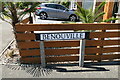
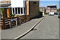
B?nouville, (Normandy landings)
Bénouville is the name of the town where Pegasus Bridge, originally called the Bénouville Bridge after the village, and where the road crossing over the Caen Canal, is located between Caen and Ouistreham in Normandy.
Nearby are other roads which also have connections with the Normandy landings.
Image
Image: © Adrian S Pye
Taken: 8 Jul 2022
0.05 miles
5
B?nouville, Lowestoft
Bénouville is the name of the town where Pegasus Bridge, originally called the Bénouville Bridge after the village, and where the road crossing over the Caen Canal, is located between Caen and Ouistreham in Normandy.
Nearby are other roads which also have connections with the Normandy landings.
Image
Image
Image
Image
Image: © Adrian S Pye
Taken: 8 Jul 2022
0.06 miles
6
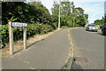
Ranville (Normandy landings)
Named after the first village liberated after the Normandy landings 6th June 1944.
This explanatory plaque stands nearby. Image
Image: © Adrian S Pye
Taken: 8 Jul 2022
0.07 miles
7
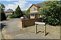
Merville, (Normandy landings)
The Battle of Merville Gun Battery occurred on 6 June 1944, as part of Operation Tonga, part of the Normandy landings, during WW2. The operation involved the 9th Parachute Battalion, part of the 3rd Parachute Brigade attached to 6th Airborne Division. The objective was to destroy the battery which threatened the Normandy landings.
Image
Image: © Adrian S Pye
Taken: 8 Jul 2022
0.07 miles
8

Ridgeville, Lowestoft
One of the road names on the Bloodmoor Estate
Image: © Adrian S Pye
Taken: 8 Jul 2022
0.09 miles
9
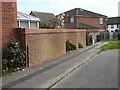
A modern crinkle-crankle wall in Deepdale
Image: © Adrian S Pye
Taken: 3 May 2023
0.17 miles
10
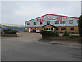
Alan Cook Removals
In South Lowestoft Industrial Estate.
Image: © Hugh Venables
Taken: 14 Apr 2018
0.17 miles