IMAGES TAKEN NEAR TO
Colsterdale, LOWESTOFT, NR33 8TN
Introduction
This page details the photographs taken nearby to Colsterdale, NR33 8TN by members of the Geograph project.
The Geograph project started in 2005 with the aim of publishing, organising and preserving representative images for every square kilometre of Great Britain, Ireland and the Isle of Man.

There are currently over 7.5m images from over14,400 individuals and you can help contribute to the project by visiting https://www.geograph.org.uk
Image Map
Images are licensed for reuse under creativecommons.org/licenses/by-sa/2.0
Notes
- Clicking on the map will re-center to the selected point.
- The higher the marker number, the further away the image location is from the centre of the postcode.
Image Listing (11 Images Found)
Images are licensed for reuse under creativecommons.org/licenses/by-sa/2.0
Image
Details
Distance
1

Junction in Carlton Colville
From Swift Close, looking towards the T junction with Colsterdale.
Image: © Derek Harper
Taken: 31 Dec 2016
0.01 miles
2

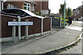
Serpentine wall in Colsterdale
Colsterdale is part of the Fortress Road housing estate in Carlton Colville
Image: © Adrian S Pye
Taken: 3 May 2023
0.02 miles
4
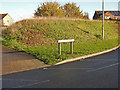
Castleton Avenue, Carlton Colville
The road is named after Claud Castleton one of two men awarded the Victoria Cross in the Great War. https://www.geograph.org.uk/photo/5504659
The other was Tom Crisp, https://www.geograph.org.uk/photo/6318739
Image: © Adrian S Pye
Taken: 12 Nov 2019
0.16 miles
5
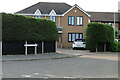
Seavert Close, Lowestoft
During World War II an American B17, "Flying Fortress" aircraft crashed in this area. The pilot 2/Lt Robert H. Portsch and Radio operator / navigator Stf/Sgt Douglas E. Seavert were killed. Their homeland was New Jersey and Ohio USA. This incident is commemorated by four named roads. Fortress Road, Portsch Close, Seavert Close and Ohio Close.
The incident occurred on the 14 March 1945. The aircraft was B17 - 44-6570 of 836th Bomb Squadron, 487th Bomb Group, based at Lavenham where an engine caught fire on take off for Hannover with Robert Portsch as the pilot; having initially extinguished the fire, it reignited, and eventually crashed at Grove Farm, Pakefield, Suffolk. 2 KIA 8 bailed out safely. The memorial can be viewed here Image
Image: © Adrian S Pye
Taken: 8 Jul 2022
0.17 miles
6
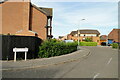
Ohio Close, Lowestoft
During World War II an American B17, "Flying Fortress" aircraft crashed in this area. The pilot 2/Lt Robert H. Portsch and Radio operator / navigator Stf/Sgt Douglas E. Seavert were killed. Their homeland was New Jersey and Ohio USA. This incident is commemorated by four named roads. Fortress Road, Portsch Close, Seavert Close and Ohio Close.
The incident occurred on the 14 March 1945. The aircraft was B17 - 44-6570 of 836th Bomb Squadron, 487th Bomb Group, based at Lavenham where an engine caught fire on take off for Hannover with Robert Portsch as the pilot; having initially extinguished the fire, it reignited, and eventually crashed at Grove Farm, Pakefield, Suffolk. 2 KIA 8 bailed out safely. The memorial can be viewed here Image
Image: © Adrian S Pye
Taken: 8 Jul 2022
0.20 miles
7
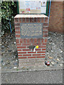
Memorial to two American airmen at Carlton Colville
"During World War II an American "Flying Fortress" aircraft crashed in this area. The pilot 2/Lt Portsch and navigator Stf/Sgt Seavert were killed. Their homeland was New Jersey and Ohio USA. This incident is commemorated by four named roads." The incident occurred on the 14 March 1945.
Fortress Road, Portsch Close, Seavert Close and Ohio Close.
Image: © Adrian S Pye
Taken: 12 Apr 2015
0.22 miles
8
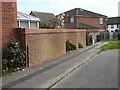
A modern crinkle-crankle wall in Deepdale
Image: © Adrian S Pye
Taken: 3 May 2023
0.23 miles