
IMAGES TAKEN NEAR TO
Uplands Road North, LOWESTOFT, NR33 8AZ
Introduction
This page details the photographs taken nearby to Uplands Road North, NR33 8AZ by members of the Geograph project.
The Geograph project started in 2005 with the aim of publishing, organising and preserving representative images for every square kilometre of Great Britain, Ireland and the Isle of Man.

There are currently over 7.5m images from over14,400 individuals and you can help contribute to the project by visiting https://www.geograph.org.uk
Image Map
Images are licensed for reuse under creativecommons.org/licenses/by-sa/2.0
Notes
- Clicking on the map will re-center to the selected point.
- The higher the marker number, the further away the image location is from the centre of the postcode.
Image Listing (18 Images Found)
Images are licensed for reuse under creativecommons.org/licenses/by-sa/2.0
Image
Details
Distance
1
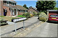
Marbella Green
The green is a pleasant grassed area of just over one third of a hectare.
Image: © Adrian S Pye
Taken: 8 Jul 2022
0.12 miles
2
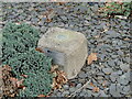
Fundamental Bench Mark: Whitton Green South
On the top is the rivet marking the 'height above datum' although it is not given. A plaque reads " This monument forms part of the Ordnance Survey National GPS Network. It is an offence to damage it."
Image: © Adrian S Pye
Taken: 2 Jan 2022
0.13 miles
3
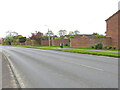
Lots of crinkles 'n' crankles in Ashburnham Way
Most of the walls in Ashburnham Way are serpentine or crinkle-crankle in style
Image: © Adrian S Pye
Taken: 3 May 2023
0.14 miles
4
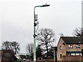
Roadside environmental sensor
The equipment was attached to this lamp post and one other on the opposite side of the road (with the blue sign). On it is written "libelium Smart Cities" and "Smart Agriculture Xtreme" on the other module of the array is written "Particle Monitor PM-X" Image Image
It was erected in October 2021.
Image: © Adrian S Pye
Taken: 22 Dec 2021
0.14 miles
5
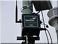
Roadside environmental sensor
The equipment was attached to this lamp post and one other on the opposite side of the road (with the blue sign). On it is written "libelium Smart Cities" and "Smart Agriculture Xtreme" on the other module of the array is written "Particle Monitor PM-X". It was erected in October 2021. https://www.geograph.org.uk/photo/7050283
Image: © Adrian S Pye
Taken: 22 Dec 2021
0.14 miles
6
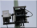
Roadside environmental sensor
The equipment was attached to this lamp post and one other on the opposite side of the road. On it is written "libelium Smart Cities" and "Smart Agriculture Xtreme" on this module of the array is written "Particle Monitor PM-X". It was erected in October 2021. Image Image
Image: © Adrian S Pye
Taken: 22 Dec 2021
0.14 miles
8
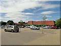
The Co-op Supermarket
Co-op Supermarket and car park at Carlton Colville, near Lowestoft.
Image: © Adrian S Pye
Taken: 21 Jul 2010
0.16 miles
9
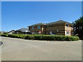
Rosedale Surgery, Carlton Colville
A busy practice at Carlton Colville near Lowestoft.
Image: © Adrian S Pye
Taken: 21 Jul 2010
0.16 miles
10
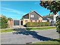
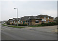
Housing, Burnt Hill Way
Attractive and well-kept housing area.
Image: © David Bremner
Taken: 25 Sep 2023
0.16 miles