
IMAGES TAKEN NEAR TO
Church Lane, LOWESTOFT, NR33 8AX
Introduction
This page details the photographs taken nearby to Church Lane, NR33 8AX by members of the Geograph project.
The Geograph project started in 2005 with the aim of publishing, organising and preserving representative images for every square kilometre of Great Britain, Ireland and the Isle of Man.

There are currently over 7.5m images from over14,400 individuals and you can help contribute to the project by visiting https://www.geograph.org.uk
Image Map
Images are licensed for reuse under creativecommons.org/licenses/by-sa/2.0
Notes
- Clicking on the map will re-center to the selected point.
- The higher the marker number, the further away the image location is from the centre of the postcode.
Image Listing (51 Images Found)
Images are licensed for reuse under creativecommons.org/licenses/by-sa/2.0
Image
Details
Distance
1
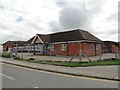
School in Church Lane, Carlton Colville
Primary school in Church Lane, Carlton Colville, near Lowestoft.
Image: © Adrian S Pye
Taken: 8 Aug 2010
0.02 miles


5

Carlton Colville Community Centre
This rather drab looking building is much better once inside. It is the hub of the community with a tennis court and playing field in the grounds.
Image: © Adrian S Pye
Taken: 14 Aug 2010
0.08 miles
6

Stubble field, Carlton Colville
Off Church Lane.
Image: © JThomas
Taken: 12 Oct 2016
0.12 miles
7

View from Church Lane, Carlton Colville
In the OS One Inch 7th Series from 1955-61 Carlton Colville was very isolated and surrounded by fields:
https://maps.nls.uk/geo/explore/#zoom=15&lat=52.4543&lon=1.6890&layers=11&b=1
As Carlton Colville has expanded with a great number of new housing estates the only fields are immediately west of Church Lane as seen here.
Image: © Marathon
Taken: 20 Oct 2018
0.12 miles
8

Church Lane, Carlton Colville
Looking north.
Image: © JThomas
Taken: 12 Oct 2016
0.13 miles
9

Garden Carpet Moth
Xanthorhoe fluctuata found resting on a wooden fence during the day, as is their wont.
Despite their name they are no threat to your floor coverings.
Image: © Adrian S Pye
Taken: 16 Sep 2020
0.15 miles
10

Carlton Colville St. Peter's church
The original fabric of the church is 13th c. but it was virtually rebuilt in 1884 in the Decorated style by Howard Gaye. Some of the original features were incorporated into the design. The church had been heavily buttressed as an early drawing of 1852 illustrates even the porch had succumbed to subsidence. The old roof was replaced with a wagon roof with bosses and moulded ribs. The thatch was replaced with tile. Everything except perhaps the stoup is reproduction from the altar to the font. The only feature which was virtually left untouched was the tower which did receive a new parapet. A scratch dial is still visible on the south side. The churchyard is well maintained, but there is little here to excite the antiquarian. A modern extension has been built over many 19th c. graves on the north side.
Image: © Adrian S Pye
Taken: 23 Mar 2007
0.15 miles