
IMAGES TAKEN NEAR TO
St. Peters Road, LOWESTOFT, NR33 8AG
Introduction
This page details the photographs taken nearby to St. Peters Road, NR33 8AG by members of the Geograph project.
The Geograph project started in 2005 with the aim of publishing, organising and preserving representative images for every square kilometre of Great Britain, Ireland and the Isle of Man.

There are currently over 7.5m images from over14,400 individuals and you can help contribute to the project by visiting https://www.geograph.org.uk
Image Map
Images are licensed for reuse under creativecommons.org/licenses/by-sa/2.0
Notes
- Clicking on the map will re-center to the selected point.
- The higher the marker number, the further away the image location is from the centre of the postcode.
Image Listing (44 Images Found)
Images are licensed for reuse under creativecommons.org/licenses/by-sa/2.0
Image
Details
Distance
1

White butterfly on Tradescantia 'Sweet Kate'
Image: © Adrian S Pye
Taken: 21 Jul 2010
0.04 miles
2
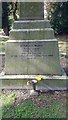
Stanley Wood war memorial
Located on the rear of the memorial to drowned scouts is the war memorial for Stanley Wood. He survived the 1914 tragedy to die on the Somme in July 1916.
Image: © Helen Steed
Taken: 22 Apr 2019
0.08 miles
3
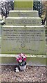
Inscription on memorial to drowned scouts
Image: © Helen Steed
Taken: 22 Apr 2019
0.08 miles
4
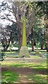
Memorial to drowned scouts
In Carlton Colville Old Cemetery
Image: © Helen Steed
Taken: 22 Apr 2019
0.08 miles
5
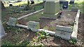
Names of the deceased surrounding the memorial to drowned scouts 1
Image: © Helen Steed
Taken: 22 Apr 2019
0.08 miles
6
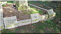
Names of the deceased surrounding the memorial to drowned scouts 2
Image: © Helen Steed
Taken: 22 Apr 2019
0.08 miles
7
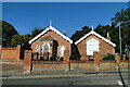
The Old School House, Carlton Colville
Closed as a school many years ago and converted into a private residence.
Image: © Adrian S Pye
Taken: 8 Aug 2022
0.16 miles
10
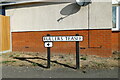
Fuller's Teasel street sign, Lowestoft
Named after the plant (Dipsacus fullonum) which was growing here when the road was built
Image: © Adrian S Pye
Taken: 8 Aug 2022
0.18 miles