
IMAGES TAKEN NEAR TO
Kipling Close, LOWESTOFT, NR33 7NZ
Introduction
This page details the photographs taken nearby to Kipling Close, NR33 7NZ by members of the Geograph project.
The Geograph project started in 2005 with the aim of publishing, organising and preserving representative images for every square kilometre of Great Britain, Ireland and the Isle of Man.

There are currently over 7.5m images from over14,400 individuals and you can help contribute to the project by visiting https://www.geograph.org.uk
Image Map
Images are licensed for reuse under creativecommons.org/licenses/by-sa/2.0
Notes
- Clicking on the map will re-center to the selected point.
- The higher the marker number, the further away the image location is from the centre of the postcode.
Image Listing (32 Images Found)
Images are licensed for reuse under creativecommons.org/licenses/by-sa/2.0
Image
Details
Distance
2
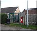
Elizabeth II postbox on Rider Haggard Lane, Kessingland
Image: © JThomas
Taken: 11 Oct 2016
0.05 miles
3

Rider Haggard Lane, Kessingland
Looking east showing position of Postbox No. NR33 3326.
See Image] for postbox.
Image: © JThomas
Taken: 11 Oct 2016
0.05 miles
4

Close up, Elizabethan postbox on Rider Haggard Lane, Kessingland
Postbox No. NR33 3326.
See Image] for wider view.
Image: © JThomas
Taken: 11 Oct 2016
0.06 miles
5

Pillbox in the garden of clifftop houses
This pillbox has been securely bricked up and stands in the seaward gardens of houses in Noah's Drive, Kessingland.
Image: © Adrian S Pye
Taken: 6 Nov 2010
0.06 miles

7

The north end of the sea wall at Kessingland
100 metres away from the high tide line the only time the wall gets wet is when it rains.
Image: © Adrian S Pye
Taken: 6 Nov 2010
0.08 miles
8
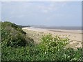
Kessingland Cliffs and Beach
In the distance, Lowestoft.
Image: © Ian Robertson
Taken: 18 May 2007
0.10 miles
9
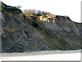
Erosion at Kessingland Cliffs
Whereas the cliffs are crumbling and falling into the sea at an alarming rate only several kilometres further south from here, the beach below the villages of Kessingland and Pakefield is extending seawards. Cliff erosion on this section of coastline appears to be caused not so much by wind and wave action but rather from the landward side by water running off the cliff face, slicing away large junks of it as it works its way down onto the beach.
Due to rapid northwards drifting of the shingle ness, the positions of beach and shoreline below Kessingland have considerably changed within the past 20 years. Old photographs taken in 1984 clearly show a field of groynes on the then northern edge of the site. By 2004 all these groynes > http://www.geograph.org.uk/photo/2164466 had completely disappeared under a sandy foreshore which appears to precede the northwards movement of the shingle beach.
Image: © Evelyn Simak
Taken: 16 Nov 2010
0.11 miles
10

Beach meets sea wall, Kessingland
A wide expanse of headland here separates the sea from the sea wall which has not tasted sea water in decades. The shingle beach at Kessingland was included as part of a larger Site of Special Scientific Interest (SSSI) in 1989. At that time the northern boundary of the site was drawn to coincide with the limit of the shingle beach. However, due to rapid northwards drifting of the shingle ness, the positions of beach and shoreline have considerably changed within the past 20 years. Old photographs taken in 1984 clearly show a field of groynes on the then northern edge of the site. By 2004 all these groynes > http://www.geograph.org.uk/photo/2164466 had completely disappeared under a sandy foreshore which appears to precede the northwards movement of the shingle ness.
Image: © Evelyn Simak
Taken: 16 Nov 2010
0.12 miles