
IMAGES TAKEN NEAR TO
Ship Road, LOWESTOFT, NR33 7DW
Introduction
This page details the photographs taken nearby to Ship Road, NR33 7DW by members of the Geograph project.
The Geograph project started in 2005 with the aim of publishing, organising and preserving representative images for every square kilometre of Great Britain, Ireland and the Isle of Man.

There are currently over 7.5m images from over14,400 individuals and you can help contribute to the project by visiting https://www.geograph.org.uk
Image Map
Images are licensed for reuse under creativecommons.org/licenses/by-sa/2.0
Notes
- Clicking on the map will re-center to the selected point.
- The higher the marker number, the further away the image location is from the centre of the postcode.
Image Listing (19 Images Found)
Images are licensed for reuse under creativecommons.org/licenses/by-sa/2.0
Image
Details
Distance
1
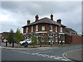
The Ship Inn, Pakefield
On Stradbroke Road.
Image: © JThomas
Taken: 13 Oct 2016
0.11 miles
2
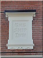
The sign on 'The Ship Inn', Stradbroke Road
Image: © Adrian S Pye
Taken: 16 Feb 2017
0.12 miles
3
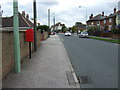
Elizabeth II postbox on Stradbroke Road, Pakefield
Postbox No. NR33 3317.
See Image] for close up.
Image: © JThomas
Taken: 13 Oct 2016
0.13 miles
4
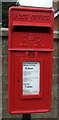
Close up, Elizabeth II postbox on Stradbroke Road, Pakefield
Postbox No. NR33 3317.
See Image] for context.
Image: © JThomas
Taken: 13 Oct 2016
0.13 miles

6
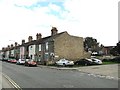
Houses in Stradbroke Road, Pakefield
This scene is close to the water tower which is on the opposite side of the road. To see the water tower > http://www.geograph.org.uk/photo/2075068
Image: © Adrian S Pye
Taken: 20 Sep 2010
0.18 miles
7
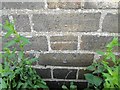
Bench mark on 41, Stradbroke Road
The cut mark is on the west face of the house and is 40cms above ground level. For more information on this and other bench marks visit the bench mark database > http://www.bench-marks.org.uk/bm35591 To view the house > http://www.geograph.org.uk/photo/2075061
Image: © Adrian S Pye
Taken: 20 Sep 2010
0.18 miles
8
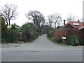
Love Lane
Love Lane at Lowestoft, Suffolk.
Image: © Keith Evans
Taken: 23 Mar 2016
0.19 miles
9
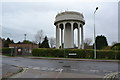
Water Tower
Water tower at Lowestoft, Suffolk.
Image: © Keith Evans
Taken: 3 Nov 2014
0.21 miles
10
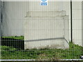
Cut mark on foot of Stradbroke Road water tower
Very faint, set in the concrete of the south-western leg of the tower. Obstructed by a wire fence and impossible to see from the road without magnification.
Seen in the centre of the image, just above the shadow.
Close-up https://www.geograph.org.uk/photo/7058558
General view https://www.geograph.org.uk/photo/4307526
Image: © Adrian S Pye
Taken: 2 Jan 2022
0.21 miles