
IMAGES TAKEN NEAR TO
Belvedere Road, LOWESTOFT, NR33 0PU
Introduction
This page details the photographs taken nearby to Belvedere Road, NR33 0PU by members of the Geograph project.
The Geograph project started in 2005 with the aim of publishing, organising and preserving representative images for every square kilometre of Great Britain, Ireland and the Isle of Man.

There are currently over 7.5m images from over14,400 individuals and you can help contribute to the project by visiting https://www.geograph.org.uk
Image Map
Images are licensed for reuse under creativecommons.org/licenses/by-sa/2.0
Notes
- Clicking on the map will re-center to the selected point.
- The higher the marker number, the further away the image location is from the centre of the postcode.
Image Listing (252 Images Found)
Images are licensed for reuse under creativecommons.org/licenses/by-sa/2.0
Image
Details
Distance
1
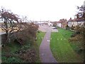
Cycle track on old railway
Old railway line converted to a cycle track, taken from the bridge over Mill Road facing north
Image: © Trevor King
Taken: 24 Oct 2004
0.03 miles
3
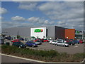
Asda 24 hour store
Asda's large Lowestoft store, it is owned by American firm Wal-Mart.
This was built on the site of a boat building works and Crown works.
Image: © Ashley Dace
Taken: 27 Aug 2009
0.04 miles
4
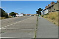
The goods yard, now Belvedere Road car park
#43
With the South Quay in sight our journey is almost at an end
Image
Image: © Adrian S Pye
Taken: 1 Aug 2022
0.05 miles
5
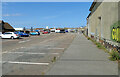
With just Belvedere Road to cross,
#44
The South Quay is straight ahead
Image
Image: © Adrian S Pye
Taken: 1 Aug 2022
0.05 miles
6
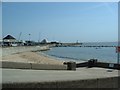
South Pier, Lowestoft
Lowestoft's South Pier
Image: © GaryReggae
Taken: 9 Jun 2005
0.05 miles
7
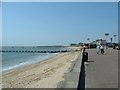
Lowestoft beach
The beach at Lowestoft, looking South from by the East Point Pavilion.
Image: © GaryReggae
Taken: 9 Jun 2005
0.05 miles
8
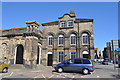
Lowestoft Railway Station
I needed to use the train to collect my bike from a service so took to opportunity to record the station. It have been threatened by demolition again by 1st East http://www.1steast.co.uk/. This means this beautiful building (in some ways it is ugly but only because it has been neglected) will be replaced my more retail space, a new station being built 40 metres down track.
The station was built in 1855 by the Lucas Brothers. It is a fine example of their work which amongst other outstanding buildings include the Royal Albert Hall. Much of the original historical structure remains albeit now sadly neglected, however Network Rail (the owners) have done some renovation works recently. It lost many of its facilities in 1992 (including its overall roof and WH Smith bookshop). It retains one of the last original British Rail enamel signs in situ on its frontage (see photograph) proudly declaring "British Railways - Lowestoft Central". The "Central" was to distinguish the station from Lowestoft North on the line to Great Yarmouth South Town which was closed in 1970.
Image: © Ashley Dace
Taken: 8 Apr 2010
0.05 miles
9
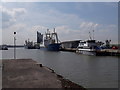
Seismic Survey Ships
Two survey ships docked at Lowestoft. These two work on oil and gas jobs but most recently (and when I was working on them) on offshore windfarm surveys. In order to build a windfarm the area needs to be free of debris (wrecks etc) both on and under the surface.
Image: © Ashley Dace
Taken: 23 May 2019
0.07 miles
10
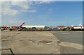
End of the line of the Oulton Broad to South Quay railway
#45
Here on the south Quay all traces of the rails have been removed and concreted over for heavy industrial use and the building of oil rigs although wind farms are the latest big money earner.
Maintenance boats go out daily from Lowestoft to service the many wind turbines which lie off the east coast.
Image: © Adrian S Pye
Taken: 1 Aug 2022
0.07 miles