
IMAGES TAKEN NEAR TO
John Street, LOWESTOFT, NR33 0EY
Introduction
This page details the photographs taken nearby to John Street, NR33 0EY by members of the Geograph project.
The Geograph project started in 2005 with the aim of publishing, organising and preserving representative images for every square kilometre of Great Britain, Ireland and the Isle of Man.

There are currently over 7.5m images from over14,400 individuals and you can help contribute to the project by visiting https://www.geograph.org.uk
Image Map
Images are licensed for reuse under creativecommons.org/licenses/by-sa/2.0
Notes
- Clicking on the map will re-center to the selected point.
- The higher the marker number, the further away the image location is from the centre of the postcode.
Image Listing (61 Images Found)
Images are licensed for reuse under creativecommons.org/licenses/by-sa/2.0
Image
Details
Distance
1
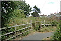
Here the railway continues onto waste ground
#32
The track follows the back gardens of houses on Bruce Street.
Image
Image: © Adrian S Pye
Taken: 31 Jul 2022
0.01 miles
2
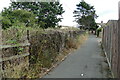
The track continues the other side of the fence on the left
#33
Travelling across barely accessible waste-land and is next seen on a small industrial estate.
Image
Image: © Adrian S Pye
Taken: 31 Jul 2022
0.03 miles
3
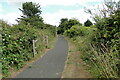
Cycle track on the old railway track
#31
Waste-ground on the left and woodland on the right
Image
Image: © Adrian S Pye
Taken: 31 Jul 2022
0.05 miles
4
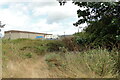
Roughly the line of the former railway
#34
The line would have clipped the edge of the large building as it curved towards the South Quay
Image
Image: © Adrian S Pye
Taken: 31 Jul 2022
0.05 miles
5
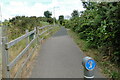
On the cycle path following the old trackbed
#30
Only waste-ground to the left and woodland and Kirkley Fen Park on the right. Image
Image: © Adrian S Pye
Taken: 31 Jul 2022
0.08 miles
6
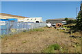
Oulton to South Quay railway
#35
Nearing its destination the line passed between the two buildings close to the Maconochies canning factory which once stood in this area. Image
A road named Maconochie Way is just over 100 Yards away.
Image: © Adrian S Pye
Taken: 1 Aug 2022
0.08 miles
8
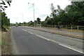
Across Tom Crisp Way to the footpath
#28
The old railway line passed over where the road now is, to what is now a foot and cycle path still roughly following the line of the trackbed.
Image
Image: © Adrian S Pye
Taken: 31 Jul 2022
0.12 miles
9

Oulton Broad to South Quay railway
#36
Continuing to curve north the line would have passed through the gap between the two buildings in the centre.
Image
Image: © Adrian S Pye
Taken: 1 Aug 2022
0.12 miles
10

Maconochie Way, Lowestoft
Named after the Maconochie Brothers factory (established 1877) which stood nearby and was the largest tinned food manufacturer in the world during the late Victorian period. It was probably the largest supplier of food to the British armed forces during the First World War. James Maconochie (1850 – 1895) established a fishmongers business in Lowestoft, Suffolk, in 1870.
Image: © Adrian S Pye
Taken: 3 Aug 2022
0.13 miles