
IMAGES TAKEN NEAR TO
Windsor Road, LOWESTOFT, NR33 0BP
Introduction
This page details the photographs taken nearby to Windsor Road, NR33 0BP by members of the Geograph project.
The Geograph project started in 2005 with the aim of publishing, organising and preserving representative images for every square kilometre of Great Britain, Ireland and the Isle of Man.

There are currently over 7.5m images from over14,400 individuals and you can help contribute to the project by visiting https://www.geograph.org.uk
Image Map
Images are licensed for reuse under creativecommons.org/licenses/by-sa/2.0
Notes
- Clicking on the map will re-center to the selected point.
- The higher the marker number, the further away the image location is from the centre of the postcode.
Image Listing (142 Images Found)
Images are licensed for reuse under creativecommons.org/licenses/by-sa/2.0
Image
Details
Distance
1
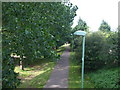
Old freight line
A small freight line was built to serve many industries next to the port. The freight lines were connected by a spur from Oulton Broad station. The lines served many industries around like the sleeper depot and fish ports.
Image: © Ashley Dace
Taken: 23 Jul 2009
0.04 miles
2
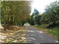
The Harbour Branch Lowestoft
The lifted branch that was for freight trains only. It left Oulton Broad South Station and went to the factories south of the river.
Image: © Ashley Dace
Taken: 27 Aug 2009
0.06 miles
3
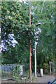
Stench pipe in Grosvenor Road, Lowestoft
Originally standing between the houses and the L & N.E.R. railway line which ran from Oulton Broad South to the Mortons and Co-op canning factories (all long since gone) it barely reaches the rooftops but is topped with a crown. It bears no obvious maker's mark.
Image: © Adrian S Pye
Taken: 3 Jul 2022
0.06 miles
4
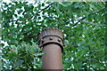
Crown topping a Stench pipe in Grosvenor Road
See more Image
Image: © Adrian S Pye
Taken: 3 Jul 2022
0.06 miles
5
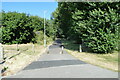
Oulton Broad to South Quay railway
#39
The line goes into a cutting at this point and passes streets of houses on the right
Image
Image: © Adrian S Pye
Taken: 1 Aug 2022
0.06 miles
6
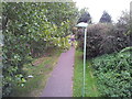
Footpath along dismantled rail line
Photo taken from the Mill Road rail bridge
Image: © Helen Steed
Taken: 20 Aug 2011
0.06 miles
7
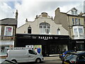
The old Kirkley Hall
Kirkley Hall building is now a gents outfitter.
It has a large Dutch gable topped with decorative ball finials and its large central arched window above the shop.
Image: © Adrian S Pye
Taken: 28 Sep 2022
0.06 miles
8
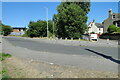
Oulton Broad to South Quay railway
#38
Leaving the confines of the industrial estate the trackbed ahead has been tarmacked and made into a path and cycle-route to Belvedere Road
Image
Image: © Adrian S Pye
Taken: 1 Aug 2022
0.07 miles
9
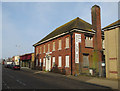
Royal Court Hotel, Lowestoft
Boarded up.
Image: © Hugh Venables
Taken: 14 Apr 2018
0.07 miles
10
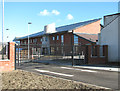
Entrance to the Kirkley Mill Health Centre
It currently houses a GP surgery, specialist neuro-rehabilitation and community nursing clinics. The recently opened site is owned and being developed into a major integrated health campus by NHS Property Services.
Image: © Evelyn Simak
Taken: 16 Feb 2014
0.07 miles