IMAGES TAKEN NEAR TO
Culley Way, GREAT YARMOUTH, NR31 9TF

Introduction

This page details the photographs taken nearby to Culley Way, NR31 9TF by members of the Geograph project.

The Geograph project started in 2005 with the aim of publishing, organising and preserving representative images for every square kilometre of Great Britain, Ireland and the Isle of Man.

There are currently over 7.5m images from over14,400 individuals and you can help contribute to the project by visiting https://www.geograph.org.uk

Image Map


Images are licensed for reuse under creativecommons.org/licenses/by-sa/2.0
Notes
  • Clicking on the map will re-center to the selected point.
  • The higher the marker number, the further away the image location is from the centre of the postcode.

Image Listing (101 Images Found)

Images are licensed for reuse under creativecommons.org/licenses/by-sa/2.0
  • ...
Image
Details
Distance
1
Lowestoft Road, Hopton-on-Sea
Looking south east.
Image: © JThomas Taken: 28 Apr 2016
0.03 miles
2
The White Hart public house
The pub is situated by the junction of Lowestoft and Station roads.
Image: © Evelyn Simak Taken: 20 Feb 2010
0.03 miles
3
Station Road. Hopton-on-Sea
At the junction with Lowestoft Road
Image: © Geographer Taken: 30 May 2012
0.04 miles
4
Approaching Lowestoft Road, Hopton-on-Sea
Image: © Geographer Taken: 30 May 2012
0.04 miles
5
Bus stop and shelter on Station Road, Hopton-on-Sea
Image: © JThomas Taken: 28 Apr 2016
0.05 miles
6
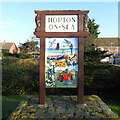
Hopton-on-Sea village sign
The sign illustrates the close connection with the sea, including beach fishing, as well as the agricultural heritage demonstrated by the tractor and rib-roller. Both churches are shown, the ruin of Hopton and Brotherton church, and the more modern church of St Margaret. https://www.geograph.org.uk/photo/6699235
Image: © Adrian S Pye Taken: 8 Dec 2020
0.05 miles
7
Hopton-on-Sea village sign
The sign illustrates the close connection with the sea, including beach fishing, as well as the agricultural heritage demonstrated by the tractor and rib-roller. Both churches are shown, the ruin of Hopton and Brotherton church, and the more modern church of St Margaret. https://www.geograph.org.uk/photo/6699233
Image: © Adrian S Pye Taken: 8 Dec 2020
0.05 miles
8
The White Hart public house
The pub is situated by the junction of Lowestoft and Station roads.
Image: © Evelyn Simak Taken: 20 Feb 2010
0.05 miles
9
Hopton in Bloom
Image: © Geographer Taken: 30 May 2012
0.05 miles
10
Hopton Doctors Surgery
On Station Road
Image: © Geographer Taken: 30 May 2012
0.05 miles
  • ...