
IMAGES TAKEN NEAR TO
Heath Road, GREAT YARMOUTH, NR31 9HL
Introduction
This page details the photographs taken nearby to Heath Road, NR31 9HL by members of the Geograph project.
The Geograph project started in 2005 with the aim of publishing, organising and preserving representative images for every square kilometre of Great Britain, Ireland and the Isle of Man.

There are currently over 7.5m images from over14,400 individuals and you can help contribute to the project by visiting https://www.geograph.org.uk
Image Map
Images are licensed for reuse under creativecommons.org/licenses/by-sa/2.0
Notes
- Clicking on the map will re-center to the selected point.
- The higher the marker number, the further away the image location is from the centre of the postcode.
Image Listing (21 Images Found)
Images are licensed for reuse under creativecommons.org/licenses/by-sa/2.0
Image
Details
Distance
1
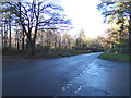
B1074 Herringfleet Road, St Olaves
At the junction with Blocka Road & Heath Road
Image: © Geographer
Taken: 11 Dec 2018
0.11 miles
2
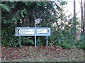
Roadsigns on the B1074 Herringfleet Road
At the junction with Blocka Road & Heath Road
Image: © Geographer
Taken: 11 Dec 2018
0.12 miles
4
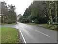
Blocka Road and Herringfleet Road junction
Image: © Adrian S Pye
Taken: 9 Dec 2014
0.12 miles
5
Blocka Road, St Olaves
At the junction with the B1074 Herringfleet Road & Heath Road
Road No.C901
Image: © Geographer
Taken: 11 Dec 2018
0.12 miles
6
Blocka Road, St Olaves
At the junction with the B1074 Herringfleet Road & Heath Road
Road No.C901
Image: © Geographer
Taken: 11 Dec 2018
0.12 miles
7
B1074 Herringfleet Road, St Olaves
At the junction with Blocka Road & Heath Road
Image: © Geographer
Taken: 11 Dec 2018
0.13 miles
8
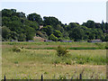
Remains of Haddiscoe swing bridge
These concrete and brick piers carried the Great Yarmouth (Southtown)-Beccles railway line across the marshes on the St Olaves side of the River Waveney, on the approach to Haddiscoe swing bridge. Trains on this line used the high level station at Haddiscoe, with a spur connection to the current Norwich-Lowestoft line.
Image: © Glen Denny
Taken: 26 Jun 2010
0.18 miles
9
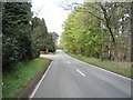
Herringfleet Road (B1074)
Looking north west through woodland.
Image: © JThomas
Taken: 28 Apr 2016
0.19 miles
10
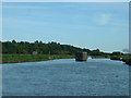
River Waveney near St Olaves
Looking towards the pillar which once supported a railway bridge
Image: © David Medcalf
Taken: 15 Aug 2005
0.21 miles