
IMAGES TAKEN NEAR TO
Beccles Road, GREAT YARMOUTH, NR31 8BL
Introduction
This page details the photographs taken nearby to Beccles Road, NR31 8BL by members of the Geograph project.
The Geograph project started in 2005 with the aim of publishing, organising and preserving representative images for every square kilometre of Great Britain, Ireland and the Isle of Man.

There are currently over 7.5m images from over14,400 individuals and you can help contribute to the project by visiting https://www.geograph.org.uk
Image Map
Images are licensed for reuse under creativecommons.org/licenses/by-sa/2.0
Notes
- Clicking on the map will re-center to the selected point.
- The higher the marker number, the further away the image location is from the centre of the postcode.
Image Listing (33 Images Found)
Images are licensed for reuse under creativecommons.org/licenses/by-sa/2.0
Image
Details
Distance
1
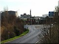
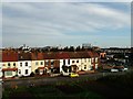
Southtown, Great Yarmouth.
Looking towards the river.
Image: © Bob Crook
Taken: 12 Dec 2006
0.01 miles
2
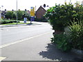
Old Cast Iron Milepost
Old cast iron milepost Gorleston, Norfolk. For close up view see http://www.geograph.org.uk/photo/1449584 and for more info see http://milestones.megalithia.com/sites/tg522052.htm do look at their home page.
Image: © Keith Evans
Taken: 19 Aug 2009
0.02 miles
3
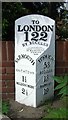
Old Milepost by the A143, Beccles Road, Gorleston
Cast iron post by the A143, in parish of GREAT YARMOUTH (GREAT YARMOUTH District), Beccles Road, Gorleston, South of Whitehorse Roundabout, opposite Jet garage, against wall behind shrubs, on West side of road. Garrett face iron casting, erected by the Ipswich to South Town, & Darsham to Bungay turnpike trust in the 19th century.
Inscription reads:-
: YARMOUTH / (2½) / SOUTHTOWN / 1½ / NELSON'S MONT. / 2½ : : TO / LONDON / 122 / BY BECCLES : : IPSWICH / 53 / BECCLES / 13 / BUNGAY / 19 :
Maker:-
: J. GARRETT. / IRON-FOUNDER / ST.MARGARET'S / IPSWICH / 1818 :
Milestone Society National ID: NO_YMIP02A.
Image: © CW Haines
Taken: 9 Jul 2013
0.04 miles
4
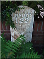
To London 122
Old cast iron milepost at Gorleston, Norfolk. For a overall view see http://www.geograph.org.uk/photo/1449598 and for more info see http://milestones.megalithia.com/sites/tg522052.htm do look at their home page. This one of a series of mileposts that follow the A.12 see http://www.geograph.org.uk/search.php?i=5288637
Image: © Keith Evans
Taken: 19 Aug 2009
0.06 miles
6
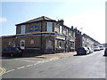
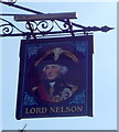
The Lord Nelson public house
On Trafalgar Road West.
Image: © JThomas
Taken: 28 Apr 2016
0.09 miles
8
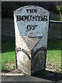
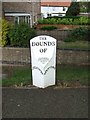
The Bounds Of
Old cast iron boundary post for Gorleston and Southtown, Norfolk
Image: © Keith Evans
Taken: 19 Aug 2009
0.11 miles
10
Old Boundary Marker by Beccles Road, Gorleston
Parish Boundary Marker by the UC road, in parish of Great Yarmouth (Great Yarmouth District), Beccles Road, Gorleston, North of Whitehorse Roundabout, opposite Wheelwrights Arms car park, on verge next to footpath.
Inscription reads:-
: GORLESTON : : THE / BOUNDS / OF : : SOUTHTOWN :
Maker:-
: J. GARRETT / IRON-FOUNDER. / ST MARGARET'S / IPSWICH. / 1822 :
Norfolk HER listed.
NHER Number: 35783 https://www.heritagegateway.org.uk/Gateway/Results_Single.aspx?uid=MNF39960&resourceID=1002
Surveyed
Milestone Society National ID: NO_GORL01pb
Image: © Milestone Society
Taken: Unknown
0.12 miles