
IMAGES TAKEN NEAR TO
Pier Road, GREAT YARMOUTH, NR31 6BP
Introduction
This page details the photographs taken nearby to Pier Road, NR31 6BP by members of the Geograph project.
The Geograph project started in 2005 with the aim of publishing, organising and preserving representative images for every square kilometre of Great Britain, Ireland and the Isle of Man.

There are currently over 7.5m images from over14,400 individuals and you can help contribute to the project by visiting https://www.geograph.org.uk
Image Map
Images are licensed for reuse under creativecommons.org/licenses/by-sa/2.0
Notes
- Clicking on the map will re-center to the selected point.
- The higher the marker number, the further away the image location is from the centre of the postcode.
Image Listing (223 Images Found)
Images are licensed for reuse under creativecommons.org/licenses/by-sa/2.0
Image
Details
Distance
1

Pier Road, Gorleston-on-Sea
The building on the left of the picture is the Pavilion Theatre.
Image: © Helen Steed
Taken: 26 Jun 2018
0.01 miles
2
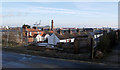
View from Cliff Hill, Gorleston
Cliff Hill is a small road running along the top of the escarpment, giving views across the harbour and lower parts. The houses in the foreground are on Beach Road (and in the same square). Beyond there is the lighthouse Image and parts of the harbour area.
Image: © John Rostron
Taken: 3 Feb 2010
0.02 miles
3
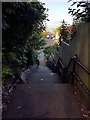
Cliff Hill to Pier Road steps
This set of steps runs from Cliff Hill at the end of Upper Cliff Road to the Beach Road / Pier Road junction. It was once a double width set of steps with gardens on each side, but has been a partially-boarded single storey since a cliff collapse several years ago.
Image: © Helen Steed
Taken: 26 Jun 2018
0.03 miles
4

Gorleston: Range Rear lighthouse
The top of Gorleston (Range Rear) lighthouse is reflected in a small puddle on the riverside path. The lighthouse was built in 1878 and faces the last stretch of the River Yare as it enters the North Sea.
Image: © Chris Downer
Taken: 29 Nov 2009
0.03 miles
5

Gorleston: the lighthouse across the Yare
Looking across the bend in the River Yare, towards Image
Image: © Chris Downer
Taken: 29 Nov 2009
0.03 miles
6

Gorleston from the South Denes
Gorleston lighthouse can be seen just left of centre.
Image: © Adrian S Pye
Taken: 29 Jan 2015
0.03 miles

8
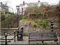
Admiral Duncan's Pump & steps to the White Lion
The plaque on the wall reads -
Admiral Duncan's Pump
The well in which this pump stands was sunk by the direction of Admiral Lord Duncan in 1797 for the purpose of watering H.M. vessels under his command and was then used by the Royal Navy throughout the Napoleonic wars.
The steps lead from Beach Road to Cliff Hill. The White Lion (once a pub, now converted into apartments) stands at the top.
Image: © Helen Steed
Taken: 14 Apr 2010
0.03 miles

