
IMAGES TAKEN NEAR TO
Yare Close, GREAT YARMOUTH, NR30 5RR
Introduction
This page details the photographs taken nearby to Yare Close, NR30 5RR by members of the Geograph project.
The Geograph project started in 2005 with the aim of publishing, organising and preserving representative images for every square kilometre of Great Britain, Ireland and the Isle of Man.

There are currently over 7.5m images from over14,400 individuals and you can help contribute to the project by visiting https://www.geograph.org.uk
Image Map
Images are licensed for reuse under creativecommons.org/licenses/by-sa/2.0
Notes
- Clicking on the map will re-center to the selected point.
- The higher the marker number, the further away the image location is from the centre of the postcode.
Image Listing (19 Images Found)
Images are licensed for reuse under creativecommons.org/licenses/by-sa/2.0
Image
Details
Distance
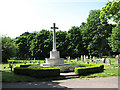
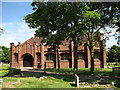
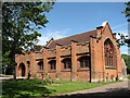
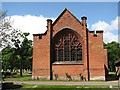
7
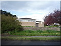
Catholic Church of St Ignatius of Loyola, Caister-on-Sea
Image: © JThomas
Taken: 27 Apr 2016
0.11 miles
8
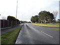
Ormesby Road, Caister-on-Sea
Heading south east.
Image: © JThomas
Taken: 27 Apr 2016
0.13 miles
9
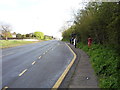
Bus stop and shelter on Ormesby Road, Caister-on-Sea
Looking north showing position of Postbox No. NR30 3048.
See Image] for postbox.
Image: © JThomas
Taken: 27 Apr 2016
0.14 miles
10

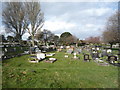
Graves of ATS girls, killed 11th May 1943
Hostile raid 497 was a daylight low-level attack by 18 FW 190s of II/SKG.10 on the Gt Yarmouth area at 0845 hours on 11 May 1943. This was a frontal attack out of the sun and early morning mist. The raiders followed a reverse course of that taken by an earlier raid on 7 May, crossing in flying W just N of Britannia Pier and attacking the N part of Gt Yarmouth, exiting over the Winterton area.
Gorleston ROC post made a sound only report identifying the incoming FW's about a minute before the attack. Caister ROC post gave the alarm to Gt Yarmouth Police and the air raid alarm was sounded only a few seconds after the first bombs fell.
14 x 500 kg HE bombs fell in various scattered residential areas in the N of the town. Some of the bombs bounced over the ground due to the low-level of their release. There was widespread destruction from bombs and cannon-fire, and with 49 people killed and 41 injured, this was the worst air-raid Gt Yarmouth endured in WW 2.
A squad of about 30 ATS girls had been exercising that morning and had just marched back to their billet at Whitfield House, a large hostel at No.8, North Drive, when it received a direct hit from an HE bomb. There were 28 fatalities in just this incident.
Four Mustangs from 613 Sqn which had just taken from Coltishall on an armed recce over the Dutch coast were vectored onto the fleeing FW 190s and pursued them out to sea at low-level, F/O Townsend managed to shoot one down, confirmed in German records.
The other girls killed in the raid were returned to their respective home parish.
Thanks to BC for the details imparted above.
Image: © Adrian S Pye
Taken: 14 Sep 2016
0.15 miles