
IMAGES TAKEN NEAR TO
Salisbury Road, GREAT YARMOUTH, NR30 4LB
Introduction
This page details the photographs taken nearby to Salisbury Road, NR30 4LB by members of the Geograph project.
The Geograph project started in 2005 with the aim of publishing, organising and preserving representative images for every square kilometre of Great Britain, Ireland and the Isle of Man.

There are currently over 7.5m images from over14,400 individuals and you can help contribute to the project by visiting https://www.geograph.org.uk
Image Map
Images are licensed for reuse under creativecommons.org/licenses/by-sa/2.0
Notes
- Clicking on the map will re-center to the selected point.
- The higher the marker number, the further away the image location is from the centre of the postcode.
Image Listing (53 Images Found)
Images are licensed for reuse under creativecommons.org/licenses/by-sa/2.0
Image
Details
Distance
1
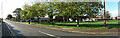
Panorama of the route of the former railway track
The route of the railway we are following arrives from the right near the red bus, around where the cars are parked and across North Denes Road on the left along where the houses have since been built, and into Yarmouth South Beach Station about 650 yards (600 metres) south from this spot.
Image: © Adrian S Pye
Taken: 4 Nov 2022
0.14 miles
2
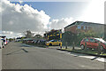
Nearing the bottom of the incline
The track here would almost be flat and turn just after the last car to round the curve and enter the final leg
Image: © Adrian S Pye
Taken: 4 Nov 2022
0.15 miles
3
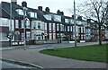
North Denes Road, Great Yarmouth
From the corner of Beaconsfield Road
Image: © David Howard
Taken: 25 Feb 2024
0.16 miles
5
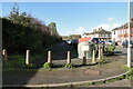
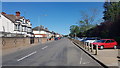
Beaconsfield Road car park on the former railway line
The line at this point would still be about the height of the wall on the left at this point having dropped from 16 feet at the top of the road to about ten.
Image: © Adrian S Pye
Taken: 4 Nov 2022
0.18 miles
6

Looking south on Great Yarmouth front
The northern part of Great Yarmouth sea front runs very straight for a very long way. After a kink in the middle it runs straight the rest of the way to the tip of the peninsula.
The toilet block on the left signals the start of the man-made attractions on the front, the first being a boating pool.
Image: © John Goldsmith
Taken: 12 May 2010
0.18 miles
7

Small Crescent on North Drive - Great Yarmouth
A small Crescent on the North Drive coast road. The crescent doesn’t appear to have a name, and neither does it show a name on a street map.
Image: © Richard Robinson
Taken: 1 Jun 2007
0.18 miles
8

The Salisbury Residential Home for the Elderly
On North Drive.
Image: © Evelyn Simak
Taken: 17 Nov 2018
0.18 miles
9

Zebra crossing on North Drive
The house on the other side of the road is The Salisbury Residential Home for the Elderly.
Image: © Evelyn Simak
Taken: 17 Nov 2018
0.18 miles
10

Norfolk Coast Path along North Drive
In the Newtown area of Great Yarmouth. The North Beach and dunes on the right.
Image: © Mat Fascione
Taken: 27 Jun 2018
0.18 miles