
IMAGES TAKEN NEAR TO
Sandringham Avenue, GREAT YARMOUTH, NR30 4DY
Introduction
This page details the photographs taken nearby to Sandringham Avenue, NR30 4DY by members of the Geograph project.
The Geograph project started in 2005 with the aim of publishing, organising and preserving representative images for every square kilometre of Great Britain, Ireland and the Isle of Man.

There are currently over 7.5m images from over14,400 individuals and you can help contribute to the project by visiting https://www.geograph.org.uk
Image Map
Images are licensed for reuse under creativecommons.org/licenses/by-sa/2.0
Notes
- Clicking on the map will re-center to the selected point.
- The higher the marker number, the further away the image location is from the centre of the postcode.
Image Listing (26 Images Found)
Images are licensed for reuse under creativecommons.org/licenses/by-sa/2.0
Image
Details
Distance
1
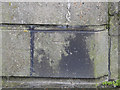
Benchmark on the pier of the old railway bridge
http://www.geograph.org.uk/photo/4327473
Image: © Adrian S Pye
Taken: 29 Jan 2015
0.05 miles
2
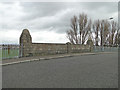
North side of Old railway bridge north of Gt. Yarmouth
Image: © Adrian S Pye
Taken: 29 Jan 2015
0.05 miles
3
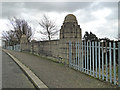
South side of the old railway bridge north of Gt. Yarmouth
On the far pier there is an OS benchmark. http://www.geograph.org.uk/photo/4327483
Image: © Adrian S Pye
Taken: 29 Jan 2015
0.05 miles
4
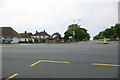
Barnard Avenue off North Drive - Great Yarmouth
Looking across North Drive and up to the top of Barnard Avenue bridge. To the left of the picture and in front of the houses is Howe Road, which runs parallel with Barnard Avenue.
Image: © Richard Robinson
Taken: 1 Jun 2007
0.11 miles
5

Small Crescent on North Drive - Great Yarmouth
A small Crescent on the North Drive coast road. The crescent doesn’t appear to have a name, and neither does it show a name on a street map.
Image: © Richard Robinson
Taken: 1 Jun 2007
0.15 miles
6

North Drive - Great Yarmouth
North Drive, showing a short piece of dual carriageway, ending next to Barnard Avenue on the right (a weak bridge, 3 tonnes maximum gross weight. See Image), converging into two-way traffic. To the left of the picture and out of view are the North Beach dunes, beach and shoreline.
Image: © Richard Robinson
Taken: 1 Jun 2007
0.15 miles


10

3? Miles
Old milestone set into the pavement saying 3½ miles to where? I assume it is the south end of South Denes as that distance works. For close up view see http://www.geograph.org.uk/photo/4753176
Image: © Keith Evans
Taken: 24 Nov 2015
0.16 miles