
IMAGES TAKEN NEAR TO
Nelson Road South, GREAT YARMOUTH, NR30 3HZ
Introduction
This page details the photographs taken nearby to Nelson Road South, NR30 3HZ by members of the Geograph project.
The Geograph project started in 2005 with the aim of publishing, organising and preserving representative images for every square kilometre of Great Britain, Ireland and the Isle of Man.

There are currently over 7.5m images from over14,400 individuals and you can help contribute to the project by visiting https://www.geograph.org.uk
Image Map
Images are licensed for reuse under creativecommons.org/licenses/by-sa/2.0
Notes
- Clicking on the map will re-center to the selected point.
- The higher the marker number, the further away the image location is from the centre of the postcode.
Image Listing (330 Images Found)
Images are licensed for reuse under creativecommons.org/licenses/by-sa/2.0
Image
Details
Distance
1
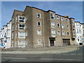
King's Court, built on the site of a WW2 bomb-site
In WW2 on the morning of Thursday the 18th of March 1943 the house which stood here was reduced to rubble when it was bombed. Eight W.R.N.S. Wrens were killed and a memorial plaque under the furthest bay records their names.
Image: © Adrian S Pye
Taken: 24 Jun 2018
0.00 miles
2
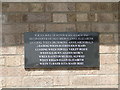
Memorial plaque to eight W.R.N.S. Wrens
The location of the plaque can be seen here http://www.geograph.org.uk/photo/5817765
There is also another memorial in St. Nicholas' church http://www.geograph.org.uk/photo/5816807
Image: © Adrian S Pye
Taken: 24 Jun 2018
0.01 miles
3
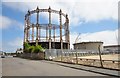
Great Yarmouth Gas Holder
Gas holder, 1884, by RP Spice.
Image: © Ashley Dace
Taken: 6 Jun 2013
0.04 miles
4
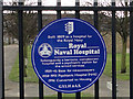
Information plaque on the Naval Hospital gates
http://www.geograph.org.uk/photo/4327461
Image: © Adrian S Pye
Taken: 29 Jan 2015
0.05 miles
5
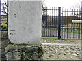
Benchmark on the gatepost of the Naval Hospital, Gt. Yarmouth
http://www.geograph.org.uk/photo/4327467
Image: © Adrian S Pye
Taken: 29 Jan 2015
0.05 miles
6
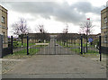
The gates of the Naval Hospital, Gt. Yarmouth
It is currently used as housing. See: http://www.geograph.org.uk/photo/4327467
Image: © Adrian S Pye
Taken: 29 Jan 2015
0.05 miles
7
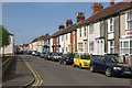
Havelock Road, Great Yarmouth
Behind the 'golden mile' of Yarmouth's sea front is a quite different world of tightly packed terraced housing. This is Havelock Road seen from its junction with Pier Place.
Image: © Stephen McKay
Taken: 3 May 2009
0.07 miles
8
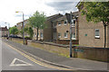
Pier Place, Great Yarmouth
Modern flats off Havelock Road.
Image: © Stephen McKay
Taken: 3 May 2009
0.08 miles
9
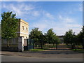
Gatehouse and main entrance to former Royal Naval Hospital
Now apartments.
Image: © Carol Rose
Taken: 30 Jul 2007
0.08 miles
10

7/8 Albert Square - Grosvenor Casinos
This Grade 2 listed building was formerly known as the Shadingfield Lodge. It dates from the mid-1860s and was designed by the architect AW Morant.
Image: © Evelyn Simak
Taken: 13 Nov 2018
0.09 miles