1
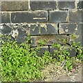
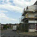
Terrace of houses in Northgate Street
Image: © Evelyn Simak
Taken: 21 Sep 2019
0.01 miles
2
Houses in Rampart Road
Rampart Road links North Quay and Northgate Street.
Image: © Evelyn Simak
Taken: 21 Sep 2019
0.02 miles
3
Town wall, Great Yarmouth – plaque
The plaque is in the style of the former Ministry of Works which was responsible for Ancient Monuments before the founding of English Heritage. On the corner of Town Wall Road at Northgate Street.
Image: © Alan Murray-Rust
Taken: 27 Jul 2024
0.03 miles
4
Bench Mark, 220 Northgate Street, Great Yarmouth
See https://www.geograph.org.uk/photo/7842486 for location.
Image: © Alan Murray-Rust
Taken: 27 Jul 2024
0.03 miles
5
Terraced houses on Palgrave Road
Image: © Evelyn Simak
Taken: 18 Oct 2018
0.03 miles
6
Great Yarmouth's Rows - Row 1 (Rampart Row)
View east along Rampart Road which was the site of Row 1. https://www.geograph.org.uk/article/Great-Yarmouths-Rows/1
Image: © Evelyn Simak
Taken: 18 Oct 2018
0.03 miles
7
220 – 222 Northgate Street, Great Yarmouth
A pair of late 18th century houses, added to on the left in the early 19th century after the demolition of the medieval North Gate. Listed Grade II as a single item.
Image: © Alan Murray-Rust
Taken: 27 Jul 2024
0.04 miles
8
Town Wall Road, Great Yarmouth
The wall can be seen on the right of the road. At this point the North Gate originally stood, demolished 1809.
There is a benchmark https://www.geograph.org.uk/photo/7842488 on the corner of the building to the right.
Image: © Alan Murray-Rust
Taken: 27 Jul 2024
0.04 miles
9
North West Tower and Rampart Rd Gt Yarmouth
Recreating this 'First' for the square https://www.geograph.org.uk/photo/40526
The road takes its name from the fact that it lies on the line of the section of the medieval town wall which ran down to the tower.
Image: © Alan Murray-Rust
Taken: 27 Jul 2024
0.04 miles
10
Great Yarmouth's Rows - Row 2 (Black Horse Row)
The entrance passage on Northgate Street. https://www.geograph.org.uk/article/Great-Yarmouths-Rows/1
Image: © Evelyn Simak
Taken: 18 Oct 2018
0.05 miles


