IMAGES TAKEN NEAR TO
Vicarage Close, GREAT YARMOUTH, NR29 5LE
Introduction
This page details the photographs taken nearby to Vicarage Close, NR29 5LE by members of the Geograph project.
The Geograph project started in 2005 with the aim of publishing, organising and preserving representative images for every square kilometre of Great Britain, Ireland and the Isle of Man.

There are currently over 7.5m images from over14,400 individuals and you can help contribute to the project by visiting https://www.geograph.org.uk
Image Map
Images are licensed for reuse under creativecommons.org/licenses/by-sa/2.0
Notes
- Clicking on the map will re-center to the selected point.
- The higher the marker number, the further away the image location is from the centre of the postcode.
Image Listing (7 Images Found)
Images are licensed for reuse under creativecommons.org/licenses/by-sa/2.0
Image
Details
Distance

2
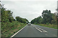
A149 towards Great Yarmouth
Here bypassing the village of Potter Heigham, following the course of the Midland and Great Northern Joint Railway, which closed here in 1959.
Image: © Robin Webster
Taken: 14 Aug 2018
0.10 miles
3

Potter Heigham village sign
This sign is located at the entrance to the village hall. It is double sided. On one side we have a soldier playing a drum. A drummer boy, home on leave, fell in love with a village girl and the pair made plans to marry before he was called back to his duties. Nightly he skated from his home to the secret meeting place where he would spend evenings with his love, in a small hut on the edge of Hickling Broad, on arrival he would beat his drum to warn of his approach. On one fatal February night the ice had started to melt and he fell through the ice to his death.
The other side of the sign has a more cheerful picture of a windpump, Norfolk sherry, harvest safely gathered in judging by the hay and straw stacks, and a team of horses ploughing the field. https://www.geograph.org.uk/photo/6668105
Image: © Adrian S Pye
Taken: 7 Nov 2020
0.10 miles
4

Potter Heigham village sign
This sign is located at the entrance to the village hall. It is double sided. On one side we have a soldier playing a drum. A drummer boy, home on leave, fell in love with a village girl and the pair made plans to marry before he was called back to his duties. Nightly he skated from his home to the secret meeting place where he would spend evenings with his love, in a small hut on the edge of Hickling Broad, on arrival he would beat his drum to warn of his approach. On one fatal February night the ice had started to melt and he fell through the ice to his death.
The other side of the sign has a more cheerful picture of a windpump, Norfolk sherry, harvest safely gathered in judging by the hay and straw stacks, and a team of horses ploughing the field.
https://www.geograph.org.uk/photo/6668101
Image: © Adrian S Pye
Taken: 7 Nov 2020
0.10 miles

6

View north along Ludham Road (A1062)
The A1062 connects with the A149 a short distance further north.
Image: © Evelyn Simak
Taken: 18 May 2008
0.21 miles