IMAGES TAKEN NEAR TO
Martham Road, GREAT YARMOUTH, NR29 5DU
Introduction
This page details the photographs taken nearby to Martham Road, NR29 5DU by members of the Geograph project.
The Geograph project started in 2005 with the aim of publishing, organising and preserving representative images for every square kilometre of Great Britain, Ireland and the Isle of Man.

There are currently over 7.5m images from over14,400 individuals and you can help contribute to the project by visiting https://www.geograph.org.uk
Image Map
Images are licensed for reuse under creativecommons.org/licenses/by-sa/2.0
Notes
- Clicking on the map will re-center to the selected point.
- The higher the marker number, the further away the image location is from the centre of the postcode.
Image Listing (30 Images Found)
Images are licensed for reuse under creativecommons.org/licenses/by-sa/2.0
Image
Details
Distance
1
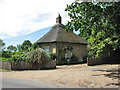
Gatehouse by entrance to the Hall
Beside Martham Road. The village of Rollesby - mentioned in the Domesday Book as Rotholfuesby and believed to have been a Viking settlement - is situated eight miles northwest of the seaside town of Great Yarmouth. Being isolated from the other Norfolk Broads, Rollesby Broad (linked to Filby and Ormesby Broad) is an ideal place for fishing and sailing as the use of motorised pleasure crafts is not permitted. In 2001 the parish, which for purposes of local government belongs to the district of Great Yarmouth, had a population of 995 in 408 households. St George's church > http://www.geograph.org.uk/photo/855320 is one of 120-odd round tower churches in Great Britain, most of which can be found in Norfolk.
Image: © Evelyn Simak
Taken: 22 Jun 2008
0.06 miles
2
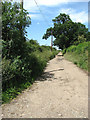
Track to the Hall
The track turns off Martham Road and leads in northerly direction.
Image: © Evelyn Simak
Taken: 22 Jun 2008
0.08 miles
3

Back Lane
Back Lane links Martham Road with the A149 (Main Road) further to the southeast.
Image: © Evelyn Simak
Taken: 22 Jun 2008
0.10 miles
4

New house - old style
The plaque above the porch informs that this house was built in 1980. The village of Rollesby - mentioned in the Domesday Book as Rotholfuesby and believed to have been a Viking settlement - is situated eight miles northwest of the seaside town of Great Yarmouth. Being isolated from the other Norfolk Broads, Rollesby Broad (linked to Filby and Ormesby Broad) is an ideal place for fishing and sailing as the use of motorised pleasure crafts is not permitted. In 2001 the parish, which for purposes of local government belongs to the district of Great Yarmouth, had a population of 995 in 408 households. St George's church > http://www.geograph.org.uk/photo/855320 is one of 120-odd round tower churches in Great Britain, most of which can be found in Norfolk.
Image: © Evelyn Simak
Taken: 22 Jun 2008
0.12 miles
5
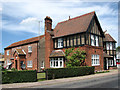
Tudor Lodge
A fine red-brick house on Martham Road. The village of Rollesby - mentioned in the Domesday Book as Rotholfuesby and believed to have been a Viking settlement - is situated eight miles northwest of the seaside town of Great Yarmouth. Being isolated from the other Norfolk Broads, Rollesby Broad (linked to Filby and Ormesby Broad) is an ideal place for fishing and sailing as the use of motorised pleasure crafts is not permitted. In 2001 the parish, which for purposes of local government belongs to the district of Great Yarmouth, had a population of 995 in 408 households. St George's church > http://www.geograph.org.uk/photo/855320 is one of 120-odd round tower churches in Great Britain, most of which can be found in Norfolk.
Image: © Evelyn Simak
Taken: 22 Jun 2008
0.13 miles
7
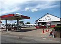
Beck's Garage
On Martham Road. The village of Rollesby - mentioned in the Domesday Book as Rotholfuesby and believed to have been a Viking settlement - is situated eight miles northwest of the seaside town of Great Yarmouth. Being isolated from the other Norfolk Broads, Rollesby Broad (linked to Filby and Ormesby Broad) is an ideal place for fishing and sailing as the use of motorised pleasure crafts is not permitted. In 2001 the parish, which for purposes of local government belongs to the district of Great Yarmouth, had a population of 995 in 408 households. St George's church > http://www.geograph.org.uk/photo/855320 is one of 120-odd round tower churches in Great Britain, most of which can be found in Norfolk.
Image: © Evelyn Simak
Taken: 22 Jun 2008
0.14 miles