
IMAGES TAKEN NEAR TO
The Acorns, Conifer Road, NR29 4UU
Introduction
This page details the photographs taken nearby to The Acorns, Conifer Road, NR29 4UU by members of the Geograph project.
The Geograph project started in 2005 with the aim of publishing, organising and preserving representative images for every square kilometre of Great Britain, Ireland and the Isle of Man.

There are currently over 7.5m images from over14,400 individuals and you can help contribute to the project by visiting https://www.geograph.org.uk
Image Map
Images are licensed for reuse under creativecommons.org/licenses/by-sa/2.0
Notes
- Clicking on the map will re-center to the selected point.
- The higher the marker number, the further away the image location is from the centre of the postcode.
Image Listing (15 Images Found)
Images are licensed for reuse under creativecommons.org/licenses/by-sa/2.0
Image
Details
Distance
1
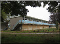
Former Pontins Holiday Camp, Hemsby
A closed, boarded up holiday camp on a grey October morning. Not an inspiring scene. It has been closed for four years.
Image: © Hugh Venables
Taken: 22 Oct 2012
0.04 miles
2

Former Pontins Holiday Camp, Hemsby
A closed, boarded up holiday camp on a grey October morning. Not an inspiring scene. It has been closed for four years.
Image: © Hugh Venables
Taken: 22 Oct 2012
0.05 miles
3
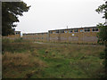
Former Pontins Holiday Camp, Hemsby
A closed, boarded up holiday camp on a grey October morning. Not an inspiring scene. It has been closed for four years.
Image: © Hugh Venables
Taken: 22 Oct 2012
0.07 miles

5

Beech House and Bickley House
Pair of houses on Newport Road.
Image: © Ian Capper
Taken: 8 Aug 2008
0.11 miles


8
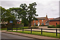
Church Farm Residential Care Home
Care home in Yarmouth Road.
Image: © Ian Capper
Taken: 8 Aug 2008
0.12 miles

10

6 - 10 Newport Road
1950s housing on Newport Road, viewed across the junction of Newport Road with Yarmouth Road and Kings Way. Kings Way was built on the route of the Midland and Great Northern Joint Railway which closed through Hemsby in 1959.
Image: © Ian Capper
Taken: 8 Aug 2008
0.15 miles