
IMAGES TAKEN NEAR TO
Rollesby Road, GREAT YARMOUTH, NR29 4SL
Introduction
This page details the photographs taken nearby to Rollesby Road, NR29 4SL by members of the Geograph project.
The Geograph project started in 2005 with the aim of publishing, organising and preserving representative images for every square kilometre of Great Britain, Ireland and the Isle of Man.

There are currently over 7.5m images from over14,400 individuals and you can help contribute to the project by visiting https://www.geograph.org.uk
Image Map
Images are licensed for reuse under creativecommons.org/licenses/by-sa/2.0
Notes
- Clicking on the map will re-center to the selected point.
- The higher the marker number, the further away the image location is from the centre of the postcode.
Image Listing (4 Images Found)
Images are licensed for reuse under creativecommons.org/licenses/by-sa/2.0
Image
Details
Distance
2
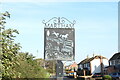
Martham village entry sign (Rollesby Road)
Martham has four of these silhouette signs at each of the four main roads into the village. Each one shows a different aspect of the village. This sign shows two ducks paddle past the bulrushes towards the seat in the pond on The Green, while a couple of horses frolic in their paddock nearby. https://www.geograph.org.uk/photo/6668173
Image: © Adrian S Pye
Taken: 7 Nov 2020
0.05 miles
3
Martham village entry sign (Rollesby Road)
Martham has four of these silhouette signs at each of the four main roads into the village. Each one shows a different aspect of the village. This sign shows two ducks paddle past the bulrushes towards the seat in the pond on The Green, while a couple of horses frolic in their paddock nearby. https://www.geograph.org.uk/photo/6668167
Image: © Adrian S Pye
Taken: 7 Nov 2020
0.05 miles
4
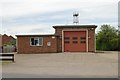
Martham fire station
Martham fire station, Rollesby Road, Martham, Norfolk
Image: © Kevin Hale
Taken: 6 Jun 2009
0.21 miles