
IMAGES TAKEN NEAR TO
Pine Close, GREAT YARMOUTH, NR29 4SG
Introduction
This page details the photographs taken nearby to Pine Close, NR29 4SG by members of the Geograph project.
The Geograph project started in 2005 with the aim of publishing, organising and preserving representative images for every square kilometre of Great Britain, Ireland and the Isle of Man.

There are currently over 7.5m images from over14,400 individuals and you can help contribute to the project by visiting https://www.geograph.org.uk
Image Map
Images are licensed for reuse under creativecommons.org/licenses/by-sa/2.0
Notes
- Clicking on the map will re-center to the selected point.
- The higher the marker number, the further away the image location is from the centre of the postcode.
Image Listing (19 Images Found)
Images are licensed for reuse under creativecommons.org/licenses/by-sa/2.0
Image
Details
Distance
1
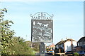
Martham village entry sign (Rollesby Road)
Martham has four of these silhouette signs at each of the four main roads into the village. Each one shows a different aspect of the village. This sign shows two ducks paddle past the bulrushes towards the seat in the pond on The Green, while a couple of horses frolic in their paddock nearby. https://www.geograph.org.uk/photo/6668173
Image: © Adrian S Pye
Taken: 7 Nov 2020
0.05 miles
2
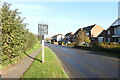
Martham village entry sign (Rollesby Road)
Martham has four of these silhouette signs at each of the four main roads into the village. Each one shows a different aspect of the village. This sign shows two ducks paddle past the bulrushes towards the seat in the pond on The Green, while a couple of horses frolic in their paddock nearby. https://www.geograph.org.uk/photo/6668167
Image: © Adrian S Pye
Taken: 7 Nov 2020
0.05 miles
4
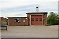
Martham fire station
Martham fire station, Rollesby Road, Martham, Norfolk
Image: © Kevin Hale
Taken: 6 Jun 2009
0.13 miles
7
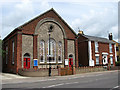
Martham Methodist Church
The biggest church in the Circuit, Martham Methodist Church is located on the B1152/Repps Road in the village centre. It was built in 1880. See also > http://www.geograph.org.uk/photo/852979.
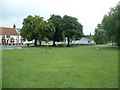
Martham has always been a large and busy village with (presently) a post office, a couple of pubs, a supermarket and a variety of other shops, doctors surgery, pharmacy and more than 30 businesses, three schools, a public library, a large playing field with skate park and multi games area and two duck ponds. In 1300 CE the village had a population of about 1,000, and during the Middle Ages Martham provided the monks in Norwich with wheat, barley and peat. C19 directories list a great number of farmers, fishermen, craftsmen and tradesmen such as grocers, butchers, tailors, drapers, shoemakers, basket makers, wheelwrights, joiners, blacksmiths, millers, brick makers, bricklayers, thatchers, glaziers, wherrymen and watchmakers. Most of the bricks seen in older houses were made locally and are of similar appearance, texture and colour. The village green > http://www.geograph.org.uk/photo/853060 is surrounded by C18 houses, some thatched; a fair and general marked used to be held here on the last Tuesday and Wednesday of July. http://www.martham.gov.uk/
Image: © Evelyn Simak
Taken: 20 Jun 2008
0.20 miles
8
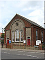
Martham Methodist Church
The biggest church in the Circuit, Martham Methodist Church is located on the B1152/Repps Road in the village centre. It was built in 1880. See also > http://www.geograph.org.uk/photo/852978.
Martham has always been a large and busy village with (presently) a post office, a couple of pubs, a supermarket and a variety of other shops, doctors surgery, pharmacy and more than 30 businesses, three schools, a public library, a large playing field with skate park and multi games area and two duck ponds. In 1300 CE the village had a population of about 1,000, and during the Middle Ages Martham provided the monks in Norwich with wheat, barley and peat. C19 directories list a great number of farmers, fishermen, craftsmen and tradesmen such as grocers, butchers, tailors, drapers, shoemakers, basket makers, wheelwrights, joiners, blacksmiths, millers, brick makers, bricklayers, thatchers, glaziers, wherrymen and watchmakers. Most of the bricks seen in older houses were made locally and are of similar appearance, texture and colour. The village green > http://www.geograph.org.uk/photo/853060 is surrounded by C18 houses, some thatched; a fair and general marked used to be held here on the last Tuesday and Wednesday of July. http://www.martham.gov.uk/
Image: © Evelyn Simak
Taken: 20 Jun 2008
0.20 miles
9

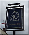
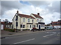
The Victoria
One of two public houses in the village, the Victoria is located on Repps Road (B1152) which is the main thoroughfare. Martham has always been a large and busy village with (presently) a post office, a couple of pubs, a supermarket and a variety of other shops, doctors surgery, pharmacy and more than 30 businesses, three schools, a public library, a large playing field with skate park and multi games area and two duck ponds. In 1300 CE the village had a population of about 1,000, and during the Middle Ages Martham provided the monks in Norwich with wheat, barley and peat. C19 directories list a great number of farmers, fishermen, craftsmen and tradesmen such as grocers, butchers, tailors, drapers, shoemakers, basket makers, wheelwrights, joiners, blacksmiths, millers, brick makers, bricklayers, thatchers, glaziers, wherrymen and watchmakers. Most of the bricks seen in older houses were made locally and are of similar appearance, texture and colour. The village green > http://www.geograph.org.uk/photo/853060 is surrounded by C18 houses, some thatched; a fair and general marked used to be held here on the last Tuesday and Wednesday of July. http://www.martham.gov.uk/
Image: © Evelyn Simak
Taken: 20 Jun 2008
0.21 miles
10
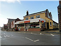
Martham Post Office
In the Street, Martham, Norfolk.
Image: © Adrian S Pye
Taken: 12 Dec 2010
0.22 miles