
IMAGES TAKEN NEAR TO
Back Lane, GREAT YARMOUTH, NR29 4PE
Introduction
This page details the photographs taken nearby to Back Lane, NR29 4PE by members of the Geograph project.
The Geograph project started in 2005 with the aim of publishing, organising and preserving representative images for every square kilometre of Great Britain, Ireland and the Isle of Man.

There are currently over 7.5m images from over14,400 individuals and you can help contribute to the project by visiting https://www.geograph.org.uk
Image Map
Images are licensed for reuse under creativecommons.org/licenses/by-sa/2.0
Notes
- Clicking on the map will re-center to the selected point.
- The higher the marker number, the further away the image location is from the centre of the postcode.
Image Listing (94 Images Found)
Images are licensed for reuse under creativecommons.org/licenses/by-sa/2.0
Image
Details
Distance
1
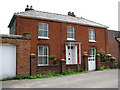
C18 farmhouse
The farmhouse of Manor Farm, in Back Lane. Martham has always been a large and busy village with (presently) a post office, a couple of pubs, a supermarket and a variety of other shops, doctors surgery, pharmacy and more than 30 businesses, three schools, a public library, a large playing field with skate park and multi games area and two duck ponds. In 1300 CE the village had a population of about 1,000, and during the Middle Ages Martham provided the monks in Norwich with wheat, barley and peat. C19 directories list a great number of farmers, fishermen, craftsmen and tradesmen such as grocers, butchers, tailors, drapers, shoemakers, basket makers, wheelwrights, joiners, blacksmiths, millers, brick makers, bricklayers, thatchers, glaziers, wherrymen and watchmakers. Most of the bricks seen in older houses were made locally and are of similar appearance, texture and colour. The village green > http://www.geograph.org.uk/photo/853060 is surrounded by C18 houses, some thatched; a fair and general marked used to be held here on the last Tuesday and Wednesday of July. http://www.martham.gov.uk/
Image: © Evelyn Simak
Taken: 20 Jun 2008
0.01 miles
2
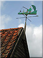
Gone fishing
Weather vane on the gable end of a garage in Back Lane. Martham has always been a large and busy village with (presently) a post office, a couple of pubs, a supermarket and a variety of other shops, doctors surgery, pharmacy and more than 30 businesses, three schools, a public library, a large playing field with skate park and multi games area and two duck ponds. In 1300 CE the village had a population of about 1,000, and during the Middle Ages Martham provided the monks in Norwich with wheat, barley and peat. C19 directories list a great number of farmers, fishermen, craftsmen and tradesmen such as grocers, butchers, tailors, drapers, shoemakers, basket makers, wheelwrights, joiners, blacksmiths, millers, brick makers, bricklayers, thatchers, glaziers, wherrymen and watchmakers. Most of the bricks seen in older houses were made locally and are of similar appearance, texture and colour. The village green > http://www.geograph.org.uk/photo/853060 is surrounded by C18 houses, some thatched; a fair and general marked used to be held here on the last Tuesday and Wednesday of July. http://www.martham.gov.uk/
Image: © Evelyn Simak
Taken: 20 Jun 2008
0.02 miles
4
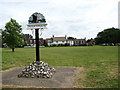
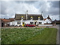
The village green
The village green is surrounded by C18 houses, some thatched; a fair and general marked used to be held here on the last Tuesday and Wednesday of July. For detailed views of the village sign see > http://www.geograph.org.uk/photo/853095 and http://www.geograph.org.uk/photo/853102.
Martham has always been a large and busy village with (presently) a post office, a couple of pubs, a supermarket and a variety of other shops, doctors surgery, pharmacy and more than 30 businesses, three schools, a public library, a large playing field with skate park and multi games area and two duck ponds. In 1300 CE the village had a population of about 1,000, and during the Middle Ages Martham provided the monks in Norwich with wheat, barley and peat. C19 directories list a great number of farmers, fishermen, craftsmen and tradesmen such as grocers, butchers, tailors, drapers, shoemakers, basket makers, wheelwrights, joiners, blacksmiths, millers, brick makers, bricklayers, thatchers, glaziers, wherrymen and watchmakers. Most of the bricks seen in older houses were made locally and are of similar appearance, texture and colour. http://www.martham.gov.uk/
Image: © Evelyn Simak
Taken: 20 Jun 2008
0.05 miles

8

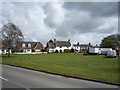
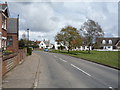
The Green, Martham with Old Signpost and Village Sign
View from the western corner of The Green.
Image: © G Laird
Taken: 27 Oct 2017
0.06 miles
9
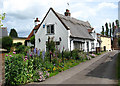
The Old School House
By the village green. Martham has always been a large and busy village with (presently) a post office, a couple of pubs, a supermarket and a variety of other shops, doctors surgery, pharmacy and more than 30 businesses, three schools, a public library, a large playing field with skate park and multi games area and two duck ponds. In 1300 CE the village had a population of about 1,000, and during the Middle Ages Martham provided the monks in Norwich with wheat, barley and peat. C19 directories list a great number of farmers, fishermen, craftsmen and tradesmen such as grocers, butchers, tailors, drapers, shoemakers, basket makers, wheelwrights, joiners, blacksmiths, millers, brick makers, bricklayers, thatchers, glaziers, wherrymen and watchmakers. Most of the bricks seen in older houses were made locally and are of similar appearance, texture and colour. The village green > http://www.geograph.org.uk/photo/853060 is surrounded by C18 houses, some thatched; a fair and general marked used to be held here on the last Tuesday and Wednesday of July. http://www.martham.gov.uk/
Image: © Evelyn Simak
Taken: 20 Jun 2008
0.06 miles
10
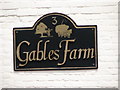
Gables Farm - farm sign
See > http://www.geograph.org.uk/photo/853147 for a view of the farmhouse.
Image: © Evelyn Simak
Taken: 20 Jun 2008
0.06 miles