
IMAGES TAKEN NEAR TO
Easterley Way, GREAT YARMOUTH, NR29 4LB
Introduction
This page details the photographs taken nearby to Easterley Way, NR29 4LB by members of the Geograph project.
The Geograph project started in 2005 with the aim of publishing, organising and preserving representative images for every square kilometre of Great Britain, Ireland and the Isle of Man.

There are currently over 7.5m images from over14,400 individuals and you can help contribute to the project by visiting https://www.geograph.org.uk
Image Map
Images are licensed for reuse under creativecommons.org/licenses/by-sa/2.0
Notes
- Clicking on the map will re-center to the selected point.
- The higher the marker number, the further away the image location is from the centre of the postcode.
Image Listing (26 Images Found)
Images are licensed for reuse under creativecommons.org/licenses/by-sa/2.0
Image
Details
Distance
1
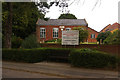
Hemsby Evangelical Congregational Church
Established in 1862.
Image: © Ian Capper
Taken: 8 Aug 2008
0.09 miles
2

Hemsby village sign
A view of the village sign at Hemsby.
Image: © Martin Pearman
Taken: Unknown
0.10 miles
3
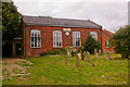
Hemsby Evangelical Congregational Church
Established in 1862.
Image: © Ian Capper
Taken: 8 Aug 2008
0.10 miles
4
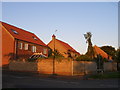
Well detailed new housing at Barley Croft, Hemsby
Image: © Carol Rose
Taken: 30 Jul 2007
0.11 miles
6
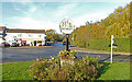
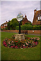
Hemsby village sign
The sign is double sided, Facing the road the windmill and a team of grey horses draw a furrow and a black-headed gull flies over their heads and some hollyhocks and other flowers complete the picture. Below the name is a longshore fishing boat pulled up on the beach. On the side facing the path is a similar scene but the farmer is harvesting the crop and appears to be handling a scythe with which he is unfamiliar. https://www.geograph.org.uk/photo/6668294 https://www.geograph.org.uk/photo/6668297
Image: © Adrian S Pye
Taken: 7 Nov 2020
0.14 miles
7
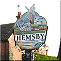
Hemsby village sign
The sign is double sided, Facing the road the windmill and a team of grey horses draw a furrow and a black-headed gull flies over their heads and some hollyhocks and other flowers complete the picture. Below the name is a longshore fishing boat pulled up on the beach. On the side facing the path is a similar scene but the farmer is harvesting the crop and appears to be handling a scythe with which he is unfamiliar. https://www.geograph.org.uk/photo/6668303
Image: © Adrian S Pye
Taken: 7 Nov 2020
0.14 miles
8
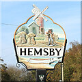
Hemsby village sign
The sign is double sided, Facing the road the windmill and a team of grey horses draw a furrow and a black-headed gull flies over their heads and some hollyhocks and other flowers complete the picture. Below the name is a longshore fishing boat pulled up on the beach. On the side facing the path is a similar scene but the farmer is harvesting the crop and appears to be handling a scythe with which he is unfamiliar. https://www.geograph.org.uk/photo/6668303
Image: © Adrian S Pye
Taken: 7 Nov 2020
0.14 miles
9
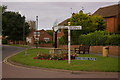
Road junction, Hembsy
Junction of Yarmouth Road (to the right), The Street (straight on), Waters Lane (to the left, not shown) and Ormesby Road (behind). In the background is the tower of St Mary's Church. For close up of village sign, see Image
Image: © Ian Capper
Taken: 8 Aug 2008
0.15 miles
10
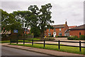
Church Farm Residential Care Home
Care home in Yarmouth Road.
Image: © Ian Capper
Taken: 8 Aug 2008
0.15 miles