
IMAGES TAKEN NEAR TO
Low Road, GREAT YARMOUTH, NR29 4BJ
Introduction
This page details the photographs taken nearby to Low Road, NR29 4BJ by members of the Geograph project.
The Geograph project started in 2005 with the aim of publishing, organising and preserving representative images for every square kilometre of Great Britain, Ireland and the Isle of Man.

There are currently over 7.5m images from over14,400 individuals and you can help contribute to the project by visiting https://www.geograph.org.uk
Image Map
Images are licensed for reuse under creativecommons.org/licenses/by-sa/2.0
Notes
- Clicking on the map will re-center to the selected point.
- The higher the marker number, the further away the image location is from the centre of the postcode.
Image Listing (133 Images Found)
Images are licensed for reuse under creativecommons.org/licenses/by-sa/2.0
Image
Details
Distance
1
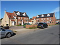
New housing in Winterton on Sea
The village continues to grow; these houses on North Market Road have only just been completed.
Image: © Richard Law
Taken: 8 Sep 2013
0.06 miles
2
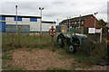
Abandoned tractor, Winterton
This scene confuses me.... an abandoned tractor outside a British Telecom compound with all the security lights facing away from the building, and a buoyancy ring attached to the fence, at least 400 metres from the sea...??
Image: © Paul E Smith
Taken: 26 Oct 2009
0.08 miles
3
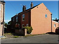
Former Primitive Methodist Chapel, Winterton
Situated on the appropriately-named Old Chapel Road, this converted chapel was built in 1843, with the majority of the cost being met by Ed Leech, whose name is recorded in a stone just above the old doorway.
Image: © Richard Law
Taken: 9 Sep 2013
0.08 miles
4

The Common
The Common, Winterton with the parish church dominating the skyline.
Image: © Paul E Smith
Taken: 26 Oct 2009
0.11 miles


7
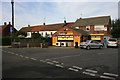
General store, Winterton
General store in the Market Place, Winterton.
Image: © Paul E Smith
Taken: 29 Oct 2009
0.12 miles
8

Winterton on Sea village sign
Winterton’s sign is double sided with the association with the sea illustrated by two steam drifters heading home past Happisburgh lighthouse on one side, and its agricultural heritage represented by a ploughing scene with the lofty steeple of Winterton’s church on the horizon. https://www.geograph.org.uk/photo/6668312
Image: © Adrian S Pye
Taken: 7 Nov 2020
0.12 miles
9

Winterton on Sea village sign
Winterton’s sign is double sided with the association with the sea illustrated by two steam drifters heading home past Happisburgh lighthouse on one side, and its agricultural heritage represented by a ploughing scene with the lofty steeple of Winterton’s church on the horizon. https://www.geograph.org.uk/photo/6668309
Image: © Adrian S Pye
Taken: 7 Nov 2020
0.12 miles
10
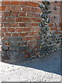
OS benchmark - Winterton cross roads
A rather faded OS cutmark in the bricks of a building on the south side of the crossroads in the middle of Winterton (the local brick doesn't weather particularly well, so the mark is not as distinct as it would originally have been. However, it's just to the left of the flints, in the 5th & 6th courses of redbrick.) Originally levelled at 4.415m above Ordnance Datum Newlyn.
Image: © Richard Law
Taken: 8 Sep 2013
0.13 miles