
IMAGES TAKEN NEAR TO
Crostwight, NORTH WALSHAM, NR28 9NW
Introduction
This page details the photographs taken nearby to NR28 9NW by members of the Geograph project.
The Geograph project started in 2005 with the aim of publishing, organising and preserving representative images for every square kilometre of Great Britain, Ireland and the Isle of Man.

There are currently over 7.5m images from over14,400 individuals and you can help contribute to the project by visiting https://www.geograph.org.uk
Image Map
Images are licensed for reuse under creativecommons.org/licenses/by-sa/2.0
Notes
- Clicking on the map will re-center to the selected point.
- The higher the marker number, the further away the image location is from the centre of the postcode.
Image Listing (50 Images Found)
Images are licensed for reuse under creativecommons.org/licenses/by-sa/2.0
Image
Details
Distance
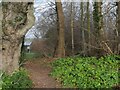

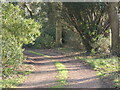


7

Footpath leading from Crostwight Church
Image: © David Pashley
Taken: 31 Dec 2020
0.06 miles

9

All Saints church, Crostwight
Across a sugar beet field.
Image: © Hugh Venables
Taken: 24 Sep 2017
0.09 miles
10

The church of All Saints
The church of All Saints > http://www.geograph.org.uk/photo/874604 - http://www.geograph.org.uk/photo/874613 is located at the end of a track that peters out into a path, adjoining the Rectory. The church tower had become so dilapidated by 1910 that its top was taken down and the remains capped in red tile. Inside, there is a C15 rood screen with intricate carvings but all its colour is gone; the rood stair entrance beside it has been blocked > http://www.geograph.org.uk/photo/874611. Along the north wall there is an extensive range of medieval wall paintings > http://www.geograph.org.uk/photo/874608 - http://www.geograph.org.uk/photo/874610. The C13 font > http://www.geograph.org.uk/photo/874615 of Purbeck marble is extensively restored. The church is kept locked but a key is available on request. For more information see: http://www.norfolkchurches.co.uk/crosswight/crosswight.htm
Image: © Evelyn Simak
Taken: 22 Aug 2007
0.09 miles