
IMAGES TAKEN NEAR TO
Ketts Road, NORTH WALSHAM, NR28 0EY
Introduction
This page details the photographs taken nearby to Ketts Road, NR28 0EY by members of the Geograph project.
The Geograph project started in 2005 with the aim of publishing, organising and preserving representative images for every square kilometre of Great Britain, Ireland and the Isle of Man.

There are currently over 7.5m images from over14,400 individuals and you can help contribute to the project by visiting https://www.geograph.org.uk
Image Map
Images are licensed for reuse under creativecommons.org/licenses/by-sa/2.0
Notes
- Clicking on the map will re-center to the selected point.
- The higher the marker number, the further away the image location is from the centre of the postcode.
Image Listing (136 Images Found)
Images are licensed for reuse under creativecommons.org/licenses/by-sa/2.0
Image
Details
Distance
2

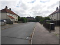
Cottage on the corner
The cottage is located on the junction of Millfield Road with Norwich Road (B1150).
Image: © Evelyn Simak
Taken: 30 Nov 2008
0.05 miles
3

View south along Burton Avenue
North Walsham's two water towers can be seen in the distance. North Walsham has two water towers > http://www.geograph.org.uk/photo/1065201. They are located beside the B1150 (Norwich Road), dwarfing everything surrounding them. A 15th century stump cross is located beside the entrance > http://www.geograph.org.uk/photo/1065047.
Image: © Evelyn Simak
Taken: 30 Nov 2008
0.05 miles
4

Burton Avenue - junction with Ketts Road
For a view taken in the opposite direction see > http://www.geograph.org.uk/photo/1065570.
Image: © Evelyn Simak
Taken: 30 Nov 2008
0.05 miles
5

Ketts Road - turning off Burton Avenue
See > http://www.geograph.org.uk/photo/1065565 for a view taken in the opposite direction.
Image: © Evelyn Simak
Taken: 30 Nov 2008
0.06 miles
6

Houses along Burton Avenue
This view was taken in northwesterly direction.
Image: © Evelyn Simak
Taken: 30 Nov 2008
0.06 miles
7
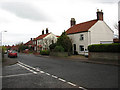
Junction of Recreation Road with Millfield Road
The view is northwesterly along Millfield Road.
Image: © Evelyn Simak
Taken: 30 Nov 2008
0.06 miles
8
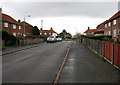
Approaching roundabout on Recreation Road
See also > http://www.geograph.org.uk/photo/1064873- this is a view taken from the opposite direction.
Image: © Evelyn Simak
Taken: 30 Nov 2008
0.07 miles
9
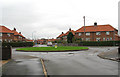
Roundabout on Recreation Road
See > http://www.geograph.org.uk/photo/1064871 for a view taken from the opposite direction.
Image: © Evelyn Simak
Taken: 30 Nov 2008
0.07 miles
10

Corrugated iron sheets
Lining an alley which links Norwich Road (B1150) with Burton Avenue > http://www.geograph.org.uk/photo/1065558 a short distance further to the west. Mercifully, a bright green hedge is growing on the other side.
Image: © Evelyn Simak
Taken: 30 Nov 2008
0.09 miles