
IMAGES TAKEN NEAR TO
Oaklands Park, NORTH WALSHAM, NR28 0AG
Introduction
This page details the photographs taken nearby to Oaklands Park, NR28 0AG by members of the Geograph project.
The Geograph project started in 2005 with the aim of publishing, organising and preserving representative images for every square kilometre of Great Britain, Ireland and the Isle of Man.

There are currently over 7.5m images from over14,400 individuals and you can help contribute to the project by visiting https://www.geograph.org.uk
Image Map
Images are licensed for reuse under creativecommons.org/licenses/by-sa/2.0
Notes
- Clicking on the map will re-center to the selected point.
- The higher the marker number, the further away the image location is from the centre of the postcode.
Image Listing (155 Images Found)
Images are licensed for reuse under creativecommons.org/licenses/by-sa/2.0
Image
Details
Distance
1
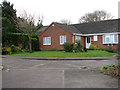
Oaklands Park
Viewed from Northfield Road. Concrete bollards block vehicular access onto Northfield Road, now only a path, linking with Mundesley Road further to the southeast.
Image: © Evelyn Simak
Taken: 21 Dec 2008
0.01 miles
2
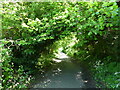
Called Northfield Road but no Motor Vehicles
Suitable for Cyclists
Image: © David Pashley
Taken: 9 Jun 2021
0.03 miles
3
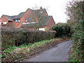
View NW along Northfield Road
Past houses on Oakfield Park. Concrete bollards block vehicular access onto Northfield Road, now only a path, linking with Mundesley Road further to the southeast.
Image: © Evelyn Simak
Taken: 21 Dec 2008
0.03 miles
4
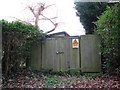
Wooden gate
A warning not to enter, issued by the Eastern Electricity Board, has been affixed to the heavy wooden gates beside Northfield Road. Concrete bollards block vehicular access onto Northfield Road, now only a path, linking with Mundesley Road further to the southeast.
Image: © Evelyn Simak
Taken: 21 Dec 2008
0.03 miles
5
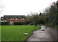
Houses on Pellew Place
The concrete bollards block vehicular access onto Northfield Road, now only a path, linking with Mundesley Road further to the southeast.
Image: © Evelyn Simak
Taken: 21 Dec 2008
0.03 miles
8
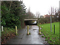
Northfield Road
The concrete bollards block vehicular access onto Northfield Road, now only a path, linking with Mundesley Road further to the southeast. The bridge seen in the background carries the B1145.
Image: © Evelyn Simak
Taken: 21 Dec 2008
0.07 miles
9
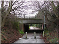
Underpass below the B1145
Access for cars onto Northfield Road has been blocked by a row of concrete bollards on both sides.
Image: © Evelyn Simak
Taken: 21 Dec 2008
0.07 miles
10
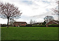
Houses on Hadfield Road
Bordering onto the green which separates them from the B1145.
Image: © Evelyn Simak
Taken: 21 Dec 2008
0.08 miles