
IMAGES TAKEN NEAR TO
The Hurn, CROMER, NR27 9QS
Introduction
This page details the photographs taken nearby to The Hurn, NR27 9QS by members of the Geograph project.
The Geograph project started in 2005 with the aim of publishing, organising and preserving representative images for every square kilometre of Great Britain, Ireland and the Isle of Man.

There are currently over 7.5m images from over14,400 individuals and you can help contribute to the project by visiting https://www.geograph.org.uk
Image Map
Images are licensed for reuse under creativecommons.org/licenses/by-sa/2.0
Notes
- Clicking on the map will re-center to the selected point.
- The higher the marker number, the further away the image location is from the centre of the postcode.
Image Listing (198 Images Found)
Images are licensed for reuse under creativecommons.org/licenses/by-sa/2.0
Image
Details
Distance

3

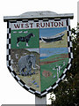
West Runton Village Sign
Village sign at the corner of Cromer Road and Station Road, just to the west of the shopping area of West Runton.
Image: © G Laird
Taken: 28 Oct 2017
0.04 miles
4
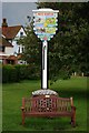
Village sign
The village sign at West Runton, Norfolk
Image: © Craig Tuck
Taken: 7 Jun 2009
0.04 miles
5
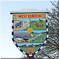
West Runton village sign
A mammoth represents the bones found in the cliffs here, and the horses are because the Norfolk Shire Horse Centre is based in the parish. The boats for the offshore fishing and the caravans for the tourist industry. A representation of the village in the lower panel has a scallop shell representing the fine sandy beach. The sun in the centre, is often seen in the sky hereabouts.
Image: © Adrian S Pye
Taken: 17 Dec 2020
0.04 miles
6
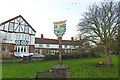
West Runton village sign
A mammoth represents the bones found in the cliffs here, and the horses are because the Norfolk Shire Horse Centre is based in the parish. The boats for the offshore fishing and the caravans for the tourist industry. A representation of the village in the lower panel has a scallop shell representing the fine sandy beach. The sun in the centre, is often seen in the sky hereabouts.
Image: © Adrian S Pye
Taken: 17 Dec 2020
0.04 miles


10

OS Flush Bracket S 0103
West Runton.
www.bench-marks.org.uk/bm1803
Image: © Richard Neale
Taken: 23 Nov 2006
0.05 miles