
IMAGES TAKEN NEAR TO
Brick Lane, CROMER, NR27 9PL
Introduction
This page details the photographs taken nearby to Brick Lane, NR27 9PL by members of the Geograph project.
The Geograph project started in 2005 with the aim of publishing, organising and preserving representative images for every square kilometre of Great Britain, Ireland and the Isle of Man.

There are currently over 7.5m images from over14,400 individuals and you can help contribute to the project by visiting https://www.geograph.org.uk
Image Map
Images are licensed for reuse under creativecommons.org/licenses/by-sa/2.0
Notes
- Clicking on the map will re-center to the selected point.
- The higher the marker number, the further away the image location is from the centre of the postcode.
Image Listing (57 Images Found)
Images are licensed for reuse under creativecommons.org/licenses/by-sa/2.0
Image
Details
Distance
2
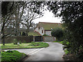
Half Year Close at left
Junction with Holgate Lane.
Image: © Evelyn Simak
Taken: 13 Mar 2008
0.09 miles
3
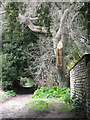
Footpath past the Old Hall
This public footpath leads to West Runton.
Image: © Evelyn Simak
Taken: 13 Mar 2008
0.10 miles
4

Geese on the village green
In East Runton. Geese and ducks populate the Image and can also be found walking on the lanes surrounding it. This pair is having a rest.
Image: © Evelyn Simak
Taken: 13 Mar 2008
0.12 miles

6
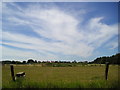
Big Norfolk sky
This was taken from a field at East Runton
Image: © janet tench
Taken: 16 Jul 2006
0.13 miles
7
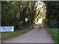
Camping and Caravan Club Site, East Runton
The entrance to this caravan site (a Certified Location) and caravan storage area is between the two railway viaducts.
Image: © Paul Shreeve
Taken: 4 Oct 2009
0.14 miles
8
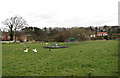
Village green and children's playground
In East Runton. The green at East Runton is populated by geese and ducks, who can occasionally also be found walking on the lanes surrounding it > Image
Image: © Evelyn Simak
Taken: 13 Mar 2008
0.15 miles
9
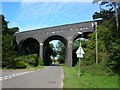
Two viaducts
The nearest viaduct formed part of a railway triangle, but has now had its track lifted. The more distant viaduct carries the Sheringham to Cromer line over East Runton.
Image: © DS Pugh
Taken: 28 Aug 2007
0.16 miles
10
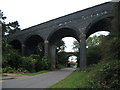
A pair of viaducts
The nearer viaduct is now disused and used to carry the rail line which avoided Cromer. The further one still carries the rail line between West Runton and Cromer.
Image: © E Gammie
Taken: 14 Aug 2011
0.16 miles