
IMAGES TAKEN NEAR TO
Sandy Lane, CROMER, NR27 9LT
Introduction
This page details the photographs taken nearby to Sandy Lane, NR27 9LT by members of the Geograph project.
The Geograph project started in 2005 with the aim of publishing, organising and preserving representative images for every square kilometre of Great Britain, Ireland and the Isle of Man.

There are currently over 7.5m images from over14,400 individuals and you can help contribute to the project by visiting https://www.geograph.org.uk
Image Map
Images are licensed for reuse under creativecommons.org/licenses/by-sa/2.0
Notes
- Clicking on the map will re-center to the selected point.
- The higher the marker number, the further away the image location is from the centre of the postcode.
Image Listing (74 Images Found)
Images are licensed for reuse under creativecommons.org/licenses/by-sa/2.0
Image
Details
Distance
1

Sandy Lane, West Runton
Looking north towards the village.
Image: © John Lucas
Taken: 6 Sep 2006
0.02 miles
2

Ford at West Runton
This ford is fed from the village pond and is found in the entrance to the Hillside Animal & Shire Horse Sanctuary at Runton Common.
Image: © John Walton
Taken: 28 Jul 2012
0.04 miles
3

Norfolk Shire Horse Centre, West Runton
The centre has a collection of different breeds of draft horses and also old horse-drawn machinery, waggons and carts.
Update December 2008:
The centre has now become the Hillside Animal Sanctuary. The sanctuary web site is here: http://hillside.org.uk/index.htm
Image: © John Lucas
Taken: 6 Sep 2006
0.05 miles
4
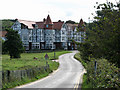
View to The Links Hotel from Station Road
Image: © Evelyn Simak
Taken: 30 Aug 2007
0.06 miles

6

The Links Hotel, West Runton
Beside Sandy Lane. "Norfolk's Longest Established Golf, Leisure and Conference Hotel - Established 1899".
Image: © John Lucas
Taken: 6 Sep 2006
0.07 miles

8

Adder Warning
At the entrance to Town Hill National Trust area, Sandy Lane, West Runton.
Image: © John Lucas
Taken: 6 Sep 2006
0.08 miles
9

The National Trust, Town Hill, West Runton
Has the added 'bonus' of an adder warning attached beneath the sign.
Image: © John Lucas
Taken: 6 Sep 2006
0.08 miles
10

Calves Well Lane, West Runton, Norfolk
Image: © John Salmon
Taken: 26 May 2008
0.09 miles