IMAGES TAKEN NEAR TO
Colne Place, CROMER, NR27 9DR
Introduction
This page details the photographs taken nearby to Colne Place, NR27 9DR by members of the Geograph project.
The Geograph project started in 2005 with the aim of publishing, organising and preserving representative images for every square kilometre of Great Britain, Ireland and the Isle of Man.

There are currently over 7.5m images from over14,400 individuals and you can help contribute to the project by visiting https://www.geograph.org.uk
Image Map
Images are licensed for reuse under creativecommons.org/licenses/by-sa/2.0
Notes
- Clicking on the map will re-center to the selected point.
- The higher the marker number, the further away the image location is from the centre of the postcode.
Image Listing (289 Images Found)
Images are licensed for reuse under creativecommons.org/licenses/by-sa/2.0
Image
Details
Distance
1
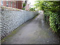
Cromer wall & alleyway
I'd call it a ginnel, but I don't know the Norfolk equivalent. It shows the local fashion for using beach stones as a building material.
Image: © Graham Hogg
Taken: 29 May 2014
0.07 miles
2
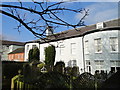
Southern aspect of The Colne House Hotel that was
The Colne House Hotel was utilised during The Great War as a VAD Hospital.
Today it has been divided into dozens of private residences and is generally inaccessible.
The Hospital was the home of the Buxton family and opened with 40 beds on March 11th 1915. It was closed on 31st January 1919. During the intervening years it had admitted 634 patients.
It was run by Mrs Frank Barclay who lived in Overstrand Road, Cromer.
On Friday August 18th 1916 a garden fete was held in aid of the hospital. Despite heavy rain over 2,000 people attended. Instead of the Aunt Sally competition a new one named 'Killing the Kaiser' proved very popular.
The band of the Royal Engineers were in attendance and entertained the crowds under the conductorship of Mr. T. Jarvis C.E.
It was not revealed just how much money was raised.
Image: © Adrian S Pye
Taken: 26 Jan 2018
0.10 miles
3
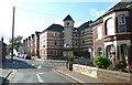
Apartment block, The Lokes, Cromer
I like the gables. Perhaps the clock tower contains the lift.
Image: © Humphrey Bolton
Taken: 31 Oct 2008
0.12 miles
4
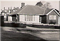
Cromer: Newhaven Close when new, 1961
Newhaven Close was laid out and its bungalows built in 1960-1. My uncle, Harry Lees (1891-1978), bought this one and retired to Cromer from Nottingham, where he had been headmaster of Sneinton Dale (Greenwood) School. His widow, my Aunt Marjorie, continued to live here until 2005. I imagine Harry took this photo shortly after they moved to Cromer in 1961. It shows the original concrete road surface - now tarmac - and the garden before planting began.
Of more general interest, perhaps, is the Victorian building in the background, Newhaven Court. Built in 1884 as the family home of the Locker Lampsons, it became a hotel after the Great War. Eminent visitors to Newhaven Court included Frederick Locker's friend Oscar Wilde, the King of Greece, Tennyson, Sir Ernest Shackleton, Prince Philip (who, as a boy, stayed in a chalet in the grounds) and Einstein. Newhaven Court was destroyed by fire on 23 January 1963 and its site is now occupied by the bungalows of Court Drive.
Image: © Harry Lees
Taken: Unknown
0.15 miles
5
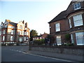
Norwich Road at the junction of St Mary's Road
Image: © David Howard
Taken: 31 May 2017
0.15 miles
6
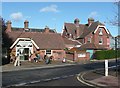
The Victorian Tea Rooms, Meadow Road, Cromer
Well placed next to the market.
Image: © Humphrey Bolton
Taken: 31 Oct 2008
0.15 miles
7
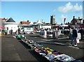
The Saturday morning market, Cromer
Few stalls, not even trestle tables. The tourist information office is in the background.
Image: © Humphrey Bolton
Taken: 31 Oct 2008
0.15 miles
8
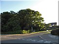
Norwich Road at the junction of Court Drive
Image: © David Howard
Taken: 31 May 2017
0.16 miles