
IMAGES TAKEN NEAR TO
Ridgeway, CROMER, NR27 0HS
Introduction
This page details the photographs taken nearby to Ridgeway, NR27 0HS by members of the Geograph project.
The Geograph project started in 2005 with the aim of publishing, organising and preserving representative images for every square kilometre of Great Britain, Ireland and the Isle of Man.

There are currently over 7.5m images from over14,400 individuals and you can help contribute to the project by visiting https://www.geograph.org.uk
Image Map
Images are licensed for reuse under creativecommons.org/licenses/by-sa/2.0
Notes
- Clicking on the map will re-center to the selected point.
- The higher the marker number, the further away the image location is from the centre of the postcode.
Image Listing (30 Images Found)
Images are licensed for reuse under creativecommons.org/licenses/by-sa/2.0
Image
Details
Distance
1
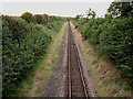
Straight to Cromer (via Roughton Road)
From the bridge on the Norwich - Cromer Road, this is the track heading north-west to Roughton Road station (alternate trains) and Cromer
Image: © Zorba the Geek
Taken: 2 Aug 2007
0.08 miles
2
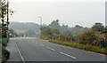
Site of Cromer (High) station from Norwich road, 1986
View NW on the hill entering Cromer. The station had been on the right. It was the terminus of the ex-Great Eastern line from Norwich. It closed to passengers on 20/9/54, to goods on 8/5/60, and trains were diverted to Cromer Beach (former M&GN station). This station was designated 'High' only from 27/9/48. (see also Image]).
Image: © Ben Brooksbank
Taken: 12 Oct 1986
0.10 miles
3
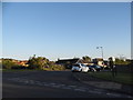
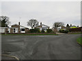
Hillside at the junction of Norwich Road
Image: © David Howard
Taken: 31 May 2017
0.10 miles
4
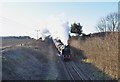
Oliver Cromwell steaming up the incline out of Cromer
Once the train had departed Cromer it was Oliver Cromwell all the way to London Liverpool Street. Here it is seen just outside Cromer with its 5 coaches plus diesel (C37). Due to the length of the crossover and track at Cromer this is the longest train possible. The other 5 were left at Norwich, the passengers ferried to Holt via vintage bus. As you can probably tell double track used to run through here, most of the Bittern Line is now single track but sections are double, allowing an hourly service.
Image: © Ashley Dace
Taken: 11 Mar 2010
0.10 miles
7
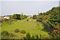
Nearing Cromer High
The lead up to the former and now demolished Cromer High station. See http://www.disused-stations.org.uk/c/cromer_high/index.shtml
Image: © Ashley Dace
Taken: 2 Sep 2011
0.17 miles
9
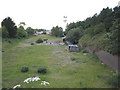
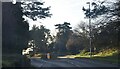
Looking north from disused railway bridge, Cromer
This used to be the line of the track leading north into central Cromer: now it's a smallholding
Image: © Zorba the Geek
Taken: 2 Aug 2007
0.18 miles
10
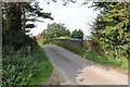
Bridge over dismantled railway
The small bridge over the now dismantled line into Cromer high station.
Image: © Ashley Dace
Taken: 2 Sep 2011
0.18 miles