IMAGES TAKEN NEAR TO
Links Avenue, CROMER, NR27 0EQ
Introduction
This page details the photographs taken nearby to Links Avenue, NR27 0EQ by members of the Geograph project.
The Geograph project started in 2005 with the aim of publishing, organising and preserving representative images for every square kilometre of Great Britain, Ireland and the Isle of Man.

There are currently over 7.5m images from over14,400 individuals and you can help contribute to the project by visiting https://www.geograph.org.uk
Image Map
Images are licensed for reuse under creativecommons.org/licenses/by-sa/2.0
Notes
- Clicking on the map will re-center to the selected point.
- The higher the marker number, the further away the image location is from the centre of the postcode.
Image Listing (35 Images Found)
Images are licensed for reuse under creativecommons.org/licenses/by-sa/2.0
Image
Details
Distance
1
Links Avenue
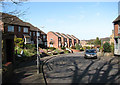
Links Avenue turns off Station Road in easterly direction; it connects with Northrepps Road further to the east.
Image: © Evelyn Simak
Taken: 12 Mar 2008
0.03 miles
2
Cromer (Suffield Park) village sign
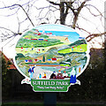
A celebration of “Poppy Land - Happy Valley” the sign declares. From Cromer church in the distance and the Foulness lighthouse on the cliffs the theme is leisure, whether it be football, golf or tourism, Cromer has it all. Clement Scott, who coined the name Poppy Land is featured on the left while Elizabeth Fry is having a chat to some old salts on the right.
Image: © Adrian S Pye
Taken: 17 Dec 2020
0.07 miles
3
Cromer (Suffield Park) village sign
A celebration of “Poppy Land - Happy Valley” the sign declares. From Cromer church in the distance and the Foulness lighthouse on the cliffs the theme is leisure, whether it be football, golf or tourism, Cromer has it all. Clement Scott, who coined the name Poppy Land is featured on the left while Elizabeth Fry is having a chat to some old salts on the right.
Image: © Adrian S Pye
Taken: 17 Dec 2020
0.07 miles
4
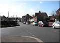
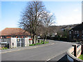
View SW along Station Road
From junction with Park Road.
Image: © Evelyn Simak
Taken: 12 Mar 2008
0.08 miles
5
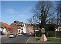
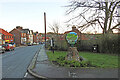
Village sign
Beside Station Road, at junction with > Image The view is northeasterly.
Image: © Evelyn Simak
Taken: 12 Mar 2008
0.09 miles
6
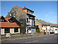
Old and new
Old and new houses, side by side on Station Road.
Image: © Evelyn Simak
Taken: 12 Mar 2008
0.09 miles
7
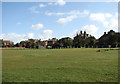
Houses on Park Road
Viewed across the green.
Image: © Evelyn Simak
Taken: 12 Mar 2008
0.10 miles
8
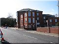
Flats on Station Road
The view is southerly, towards junctions with Salisbury Road and Mill Road beyond.
Image: © Evelyn Simak
Taken: 12 Mar 2008
0.12 miles
9
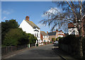
Looking east along Harbord Road
Image: © Evelyn Simak
Taken: 12 Mar 2008
0.12 miles