
IMAGES TAKEN NEAR TO
Abbey Park, SHERINGHAM, NR26 8SP
Introduction
This page details the photographs taken nearby to Abbey Park, NR26 8SP by members of the Geograph project.
The Geograph project started in 2005 with the aim of publishing, organising and preserving representative images for every square kilometre of Great Britain, Ireland and the Isle of Man.

There are currently over 7.5m images from over14,400 individuals and you can help contribute to the project by visiting https://www.geograph.org.uk
Image Map
Images are licensed for reuse under creativecommons.org/licenses/by-sa/2.0
Notes
- Clicking on the map will re-center to the selected point.
- The higher the marker number, the further away the image location is from the centre of the postcode.
Image Listing (22 Images Found)
Images are licensed for reuse under creativecommons.org/licenses/by-sa/2.0
Image
Details
Distance

2
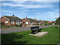
Houses on Briton's Lane in Beeston Regis
Image: © Evelyn Simak
Taken: 30 Aug 2007
0.13 miles
6

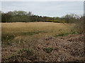
Beeston Regis Common
A mix of wet fenland and drier scrub and woodland. In the foreground a large area of gorse has been cleared to allow heathland to regenerate.
Image: © Hugh Venables
Taken: 18 Apr 2016
0.16 miles
7
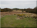
Beeston Regis Common
Looking towards Beeston Bump from the pillbox.
Image: © Hugh Venables
Taken: 18 Apr 2016
0.17 miles
8
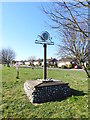
Beeston Regis village sign
https://www.geograph.org.uk/photo/6097455
Image: © Adrian S Pye
Taken: 24 Mar 2019
0.18 miles
9
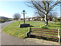
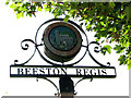
Beeston Regis village sign
A simple circular sign showing the church and the dates 1100 and 2000 indicating that the village had a population of 1100 in that year. Beeston Regis was once plain old Beeston-next-the-Sea, but in 1399 when Henry Bolingbroke, Earl of Lancaster, became King Henry IV, it became Beeston Regis and property of the king", and the living and manor of Beeston became part of the Crown and the Lancaster Inheritance. But the sign doesn’t mention that https://www.geograph.org.uk/photo/6097455.
Image: © Adrian S Pye
Taken: 24 Mar 2019
0.18 miles
10
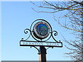
Beeston Regis village sign (detail)
A simple circular sign showing the church and the dates 1100 and 2000 indicating that the village had a population of 1100 in that year. Beeston Regis was once plain old Beeston-next-the-Sea, but in 1399 when Henry Bolingbroke, Earl of Lancaster, became King Henry IV, it became Beeston Regis and property of the king", and the living and manor of Beeston became part of the Crown and the Lancaster Inheritance. But the sign doesn’t mention that. https://www.geograph.org.uk/photo/6097453
Image: © Adrian S Pye
Taken: 24 Mar 2019
0.18 miles