
IMAGES TAKEN NEAR TO
High Street, HOLT, NR25 7RX
Introduction
This page details the photographs taken nearby to High Street, NR25 7RX by members of the Geograph project.
The Geograph project started in 2005 with the aim of publishing, organising and preserving representative images for every square kilometre of Great Britain, Ireland and the Isle of Man.

There are currently over 7.5m images from over14,400 individuals and you can help contribute to the project by visiting https://www.geograph.org.uk
Image Map
Images are licensed for reuse under creativecommons.org/licenses/by-sa/2.0
Notes
- Clicking on the map will re-center to the selected point.
- The higher the marker number, the further away the image location is from the centre of the postcode.
Image Listing (469 Images Found)
Images are licensed for reuse under creativecommons.org/licenses/by-sa/2.0
Image
Details
Distance

2

Customs House and adjoining passage
This narrow passage beside Customs House > http://www.geograph.org.uk/photo/842777 links High Street (A149) with Cley mill > http://www.geograph.org.uk/photo/842819 and the 17th century deep water quay. See > http://www.geograph.org.uk/photo/842779 for a view taken from the opposite direction.
Image: © Evelyn Simak
Taken: 11 Jun 2008
0.02 miles
3

Traditional Norfolk flint and brick cottage
Along the High Street, Cley.
Image: © Pauline E
Taken: 7 May 2013
0.02 miles
4

Passage to High Street
Linking Cley mill and the 17th century deep water quay with High Street (A149) a short distance to the east. See > http://www.geograph.org.uk/photo/842779 for a view from the other direction. For detail see > http://www.geograph.org.uk/photo/842789 and http://www.geograph.org.uk/photo/842793.
Image: © Evelyn Simak
Taken: 11 Jun 2008
0.02 miles

6

1 & 2 Long House Yard, Cley next the Sea
Once a single house, but now divided into two cottages, which date back to the 15th century. There is a small piece of a 15th century wall painting of a unicorn and mirror on the internal east gable wall. The whole row was Grade II listed https://britishlistedbuildings.co.uk/101172597-the-long-house-1-and-2-long-house-yard-cley-next-the-sea#.XYhuEyhKhPY & https://historicengland.org.uk/listing/the-list/list-entry/1172597 in 1987.
Image: © Richard Law
Taken: 24 Jul 2019
0.02 miles
7

Cley village and windmill
Seen from the far bank of the River Glaven.
Image: © Oliver Dixon
Taken: 12 Jun 2012
0.03 miles
8
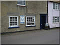
Newspaper sales, Cley Next The Sea
From a front window.
Image: © Hugh Venables
Taken: 3 Jul 2016
0.03 miles
9

The White House, Cley next the Sea
Built in the 18th century, and Grade II listed https://britishlistedbuildings.co.uk/101373512-the-white-house-cley-next-the-sea#.XYhvrShKhPY & https://historicengland.org.uk/listing/the-list/list-entry/1373512 in 1987.
Image: © Richard Law
Taken: 24 Jul 2019
0.03 miles
10
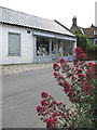
Crabpot Books
A book shop in High Street.
Present-day Cley is not in the same location as the medieval village of Cley used to be. This was located south of St Margaret's church > http://www.geograph.org.uk/photo/309410 and had a busy harbour, which was ruined by embanking in the 1640s by Sir Henry Calthorpe. A fire had already encouraged relocation in 1612. When Thomas Telford had been called in, in 1822, to advise on the problem of silting the Cley channel, his advice was ignored and the once busy port is now history. Many of the houses and cottages that line the narrow High Street (A149) through the village are built from flint and brick and date from the 17th and 18th centuries.
Image: © Evelyn Simak
Taken: 11 Jun 2008
0.03 miles