
IMAGES TAKEN NEAR TO
Old Post Office Lane, HOLT, NR25 7RD
Introduction
This page details the photographs taken nearby to Old Post Office Lane, NR25 7RD by members of the Geograph project.
The Geograph project started in 2005 with the aim of publishing, organising and preserving representative images for every square kilometre of Great Britain, Ireland and the Isle of Man.

There are currently over 7.5m images from over14,400 individuals and you can help contribute to the project by visiting https://www.geograph.org.uk
Image Map
Images are licensed for reuse under creativecommons.org/licenses/by-sa/2.0
Notes
- Clicking on the map will re-center to the selected point.
- The higher the marker number, the further away the image location is from the centre of the postcode.
Image Listing (441 Images Found)
Images are licensed for reuse under creativecommons.org/licenses/by-sa/2.0
Image
Details
Distance
2
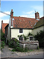
Traditional cottage
Beside High Street.
Present-day Cley is not in the same location as the medieval village of Cley used to be. This was located south of St Margaret's church > http://www.geograph.org.uk/photo/309410 and had a busy harbour, which was ruined by embanking in the 1640s by Sir Henry Calthorpe. A fire had already encouraged relocation in 1612. When Thomas Telford had been called in, in 1822, to advise on the problem of silting the Cley channel, his advice was ignored and the once busy port is now history. Many of the houses and cottages that line the narrow High Street (A149) through the village are built from flint and brick and date from the 17th and 18th centuries.
Image: © Evelyn Simak
Taken: 11 Jun 2008
0.01 miles
3

C18 houses lining High Street
Present-day Cley is not in the same location as the medieval village of Cley used to be. This was located south of St Margaret's church > http://www.geograph.org.uk/photo/309410 and had a busy harbour, which was ruined by embanking in the 1640s by Sir Henry Calthorpe. A fire had already encouraged relocation in 1612. When Thomas Telford had been called in, in 1822, to advise on the problem of silting the Cley channel, his advice was ignored and the once busy port is now history. Many of the houses and cottages that line the narrow High Street (A149) through the village are built from flint and brick and date from the 17th and 18th centuries.
Image: © Evelyn Simak
Taken: 11 Jun 2008
0.01 miles
4
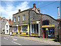
Made in Cley
Starr House, dating from the mid-19th century, presently houses a pottery and gift shop. Adjoining it is > Image
Present-day Cley is not in the same location as the medieval village of Cley used to be. This was located south of St Margaret's church > http://www.geograph.org.uk/photo/309410 and had a busy harbour, which was ruined by embanking in the 1640s by Sir Henry Calthorpe. A fire had already encouraged relocation in 1612. When Thomas Telford had been called in, in 1822, to advise on the problem of silting the Cley channel, his advice was ignored and the once busy port is now history. Many of the houses and cottages that line the narrow High Street (A149) through the village are built from flint and brick and date from the 17th and 18th centuries.
Image: © Evelyn Simak
Taken: 11 Jun 2008
0.01 miles
5

Rocket House
Grade II listed. http://www.britishlistedbuildings.co.uk/en-224581-rocket-house-cley-next-the-sea-norfolk
Image: © N Chadwick
Taken: 30 Dec 2013
0.01 miles
6

Whaleborne House, Cley next the Sea
Once the village Post Office, and with an 18th century facade on an older core, the house was Grade II listed https://britishlistedbuildings.co.uk/101049855-whaleborne-house-cley-next-the-sea#.XY4_Z0ZKjIU & https://historicengland.org.uk/listing/the-list/list-entry/1049855 in 1952. Probably its most unusual feature is the cornice (just below the pantiled roof) which is formed of a row of mammalian vertebrae - I suspect they're from cattle or possibly sheep. Nice touch.
Image: © Richard Law
Taken: 24 Jul 2019
0.01 miles
7
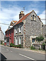
Whalebone House
This is a late 18th century house built from flint and brick, with stone quoins and pieces of bone inserted around the windows and eaves cornice. Adjoining it is Rocket House, dating from the 18th century also, with a 19th century porch.
Present-day Cley is not in the same location as the medieval village of Cley used to be. This was located south of St Margaret's church > http://www.geograph.org.uk/photo/309410 and had a busy harbour, which was ruined by embanking in the 1640s by Sir Henry Calthorpe. A fire had already encouraged relocation in 1612. When Thomas Telford had been called in, in 1822, to advise on the problem of silting the Cley channel, his advice was ignored and the once busy port is now history. Many of the houses and cottages that line the narrow High Street (A149) through the village are built from flint and brick and date from the 17th and 18th centuries.
Image: © Evelyn Simak
Taken: 11 Jun 2008
0.01 miles

10
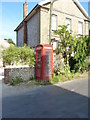
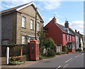
K6 phone box, Cley next the Sea
Situated mid-way along the High Street, this classic 1930s phone box, designed by Sir Giles Gilbert Scott, was Grade II listed https://britishlistedbuildings.co.uk/101373505-k6-telephone-kiosk-cley-next-the-sea#.XYxn4ChKhPY & https://historicengland.org.uk/listing/the-list/list-entry/1373505 in 1988.
Image: © Richard Law
Taken: 24 Jul 2019
0.01 miles