
IMAGES TAKEN NEAR TO
Weybourne, HOLT, NR25 7EX
Introduction
This page details the photographs taken nearby to NR25 7EX by members of the Geograph project.
The Geograph project started in 2005 with the aim of publishing, organising and preserving representative images for every square kilometre of Great Britain, Ireland and the Isle of Man.

There are currently over 7.5m images from over14,400 individuals and you can help contribute to the project by visiting https://www.geograph.org.uk
Image Map
Images are licensed for reuse under creativecommons.org/licenses/by-sa/2.0
Notes
- Clicking on the map will re-center to the selected point.
- The higher the marker number, the further away the image location is from the centre of the postcode.
Image Listing (241 Images Found)
Images are licensed for reuse under creativecommons.org/licenses/by-sa/2.0
Image
Details
Distance
1
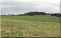
Weybourne Windmill and Weybourne Hall
Holiday lodges surround the hall in this view from the Norfolk Coast Path.
Image: © Pauline E
Taken: 14 Sep 2012
0.00 miles
2
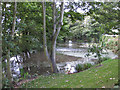
Small lake at Weybourne Hall Holiday Park
Spring Beck empties into this small lake in the holiday park.
Image: © Pauline E
Taken: 14 Sep 2012
0.07 miles
3
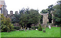
All Saints, Weybourne, Norfolk - Priory Ruins
Image: © John Salmon
Taken: 30 Sep 2005
0.07 miles
4
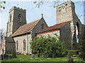
C12 Augustinian priory ruin adjoining All Saints church
Image: © Evelyn Simak
Taken: Unknown
0.08 miles
5
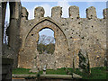
Weybourne Priory
Some restoration work has been taking place, including removal of trees.
See Image for history of the priory.
Image: © Ian Taylor
Taken: 30 Oct 2009
0.08 miles
6
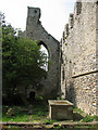
C12 Augustinian priory ruin adjoining All Saints church
Image: © Evelyn Simak
Taken: Unknown
0.08 miles
9
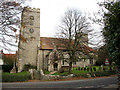
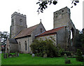
All Saints Church (1)
... viewed from the junction of Holt Road with the A149 (Sheringham Road). What appears to be another tower at the east end of the church (at right) is part of the ruin of a 12th century priory > http://www.geograph.org.uk/photo/879506 - http://www.geograph.org.uk/photo/879513.
Image: © Evelyn Simak
Taken: 16 Nov 2007
0.08 miles
10
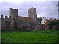
The ruins of Weybourne Priory
The priory was founded as a house of Augustinian canons towards the end of the 12th or at the beginning of the 13th century by Sir Ralph Mainwaring . The monument includes the remains of the priory church dating from the early 13th to the 15th century but incorporating parts of an earlier church dated to the 11th century, together with the remains of the conventual buildings to the north of the church and of associated buildings and water management features, lying to the north and east of these within the known area of the monastic precinct.
Image: © Mark Hobbs
Taken: 13 Nov 2006
0.09 miles