
IMAGES TAKEN NEAR TO
Norwich Road, HOLT, NR25 6SH
Introduction
This page details the photographs taken nearby to Norwich Road, NR25 6SH by members of the Geograph project.
The Geograph project started in 2005 with the aim of publishing, organising and preserving representative images for every square kilometre of Great Britain, Ireland and the Isle of Man.

There are currently over 7.5m images from over14,400 individuals and you can help contribute to the project by visiting https://www.geograph.org.uk
Image Map
Images are licensed for reuse under creativecommons.org/licenses/by-sa/2.0
Notes
- Clicking on the map will re-center to the selected point.
- The higher the marker number, the further away the image location is from the centre of the postcode.
Image Listing (10 Images Found)
Images are licensed for reuse under creativecommons.org/licenses/by-sa/2.0
Image
Details
Distance
2
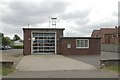
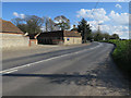
Holt fire station
Holt fire station, Norwich Road, Holt, Norfolk
Image: © Kevin Hale
Taken: 6 Jun 2009
0.02 miles
4
Approaching the island
Leaving Holt after our enjoyable railway ride.
Image: © Malcolm Neal
Taken: 5 Aug 2019
0.14 miles
9
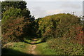
Part of the future Norfolk Orbital Railway?
The North Norfolk Railway ends just short of Holt town, but the land opposite the station entrance has a sign saying it has been bought to extend this line. The Norfolk Orbital Railway plans, among other things, to link Holt with Melton Constable and then Fakenham. This path is part of the disused track to Melton Constable.
Image: © Chris
Taken: 1 Oct 2014
0.22 miles
10
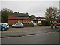
Holt Community Centre
On Kerridge Way.
Image: © Hugh Venables
Taken: 20 Oct 2017
0.24 miles