IMAGES TAKEN NEAR TO
Kelling Close, HOLT, NR25 6RU
Introduction
This page details the photographs taken nearby to Kelling Close, NR25 6RU by members of the Geograph project.
The Geograph project started in 2005 with the aim of publishing, organising and preserving representative images for every square kilometre of Great Britain, Ireland and the Isle of Man.

There are currently over 7.5m images from over14,400 individuals and you can help contribute to the project by visiting https://www.geograph.org.uk
Image Map
Images are licensed for reuse under creativecommons.org/licenses/by-sa/2.0
Notes
- Clicking on the map will re-center to the selected point.
- The higher the marker number, the further away the image location is from the centre of the postcode.
Image Listing (57 Images Found)
Images are licensed for reuse under creativecommons.org/licenses/by-sa/2.0
Image
Details
Distance
3
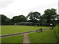
Holt Bowls Club
Holt Bowls Club is situated next to the playing fields, Woodfield Road, off Kelling Road, Holt.
Image: © G Laird
Taken: 16 Jun 2014
0.16 miles
4
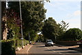
Holt: Cromer Road, "Holm Oaks" and Burrell Close
With my pockets stuffed with sweet chestnuts as I made my way from the station, I then noticed some unusual acorns on the ground under the dark green trees on the left. Then my eye was caught by a sign: "Holm Oaks B & B".
Having tried in vain to grow myself a Holm Oak in the past, I was scratting around looking for a good acorn or two when I was approached by the lady who lived there and wanted to know if I had lost something. When I explained she kindly pulled me a seedling out of a planter where she kept a collection of them, and I tucked it in my bag.
Image: © Chris
Taken: 1 Oct 2014
0.17 miles
5
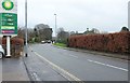
Cromer Road, Holt
A reverse view of Image, looking along the road out of Holt from the BP station.
Image: © Derek Harper
Taken: 2 Jan 2016
0.18 miles
6
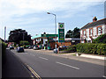
BP Filling Station
Located in Cromer Road, Holt
Image: © John Lucas
Taken: 6 Sep 2006
0.19 miles
7
To Holt 3 And A Half Furlongs
Old milestone on the A.148 at Holt, Norfolk stating the distance not in miles but furlongs. For close up view see http://www.geograph.org.uk/photo/1639648
Image: © Keith Evans
Taken: 29 Dec 2009
0.19 miles
8
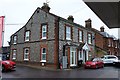
Cromer Road, Holt
This flint house forms part of the premises of the BP station shown in Image
Image: © Derek Harper
Taken: 2 Jan 2016
0.20 miles
9
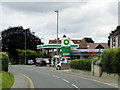
B P Services Thurlow Nunn Standen, Cromer Road, Holt
Image: © David Dixon
Taken: 3 Aug 2015
0.20 miles