
IMAGES TAKEN NEAR TO
William's Way, HOLT, NR25 6PB
Introduction
This page details the photographs taken nearby to William's Way, NR25 6PB by members of the Geograph project.
The Geograph project started in 2005 with the aim of publishing, organising and preserving representative images for every square kilometre of Great Britain, Ireland and the Isle of Man.

There are currently over 7.5m images from over14,400 individuals and you can help contribute to the project by visiting https://www.geograph.org.uk
Image Map
Images are licensed for reuse under creativecommons.org/licenses/by-sa/2.0
Notes
- Clicking on the map will re-center to the selected point.
- The higher the marker number, the further away the image location is from the centre of the postcode.
Image Listing (9 Images Found)
Images are licensed for reuse under creativecommons.org/licenses/by-sa/2.0
Image
Details
Distance
1
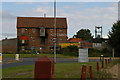
Former feed merchant's mill, on the Holt bypass
Image: © Christopher Hilton
Taken: 19 Aug 2014
0.16 miles
2
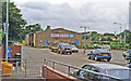
Site of Holt station, 1997
View eastward, towards Sheringham and Cromer: ex-M&GN Melton Constable - Cromer Beach line, closed 6/4/64 (goods 28/12/64) as far as Sheringham. Nearby, a new station was built in 1987 by the heritage North Norfolk Railway, as a terminus of their line from Sheringham.
Image: © Ben Brooksbank
Taken: 20 Jun 1997
0.17 miles
3
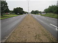
Holt railway station (site), Norfolk
Opened in 1884 on what became part of the Midland and Great Northern Railways' joint line across North Norfolk from Melton Constable to Yarmouth via Sheringham. From 1884 to 1887 it was a terminus from Melton Constable, until the line was extended. The line and station closed in 1964 and all trace was erased by the building of the A148 Holt by-pass.
View south west towards Melton Constable taken from approximately the site of the former level crossing. The North Norfolk Railway opened a replacement Holt station in 1987 - see Image
Image: © Nigel Thompson
Taken: 29 Jun 2016
0.19 miles
5
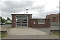
Holt fire station
Holt fire station, Norwich Road, Holt, Norfolk
Image: © Kevin Hale
Taken: 6 Jun 2009
0.23 miles
8
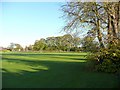
Playing fields, Holt
Belonging, I think, to Gresham's School
Image: © Humphrey Bolton
Taken: 29 Oct 2008
0.24 miles
9
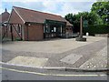
Peter Taylor Funeral Service
Haysel House, Station Road, NR25 6BS. Established 1996.
Image: © Peter Holmes
Taken: 16 Jun 2015
0.24 miles