IMAGES TAKEN NEAR TO
The Dell, HOLT, NR25 6NG
Introduction
This page details the photographs taken nearby to The Dell, NR25 6NG by members of the Geograph project.
The Geograph project started in 2005 with the aim of publishing, organising and preserving representative images for every square kilometre of Great Britain, Ireland and the Isle of Man.

There are currently over 7.5m images from over14,400 individuals and you can help contribute to the project by visiting https://www.geograph.org.uk
Image Map
Images are licensed for reuse under creativecommons.org/licenses/by-sa/2.0
Notes
- Clicking on the map will re-center to the selected point.
- The higher the marker number, the further away the image location is from the centre of the postcode.
Image Listing (22 Images Found)
Images are licensed for reuse under creativecommons.org/licenses/by-sa/2.0
Image
Details
Distance
2
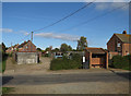
Norfolk brick and flint house
A substantial house in Bodham.
Image: © Pauline E
Taken: 18 Jun 2014
0.05 miles
4
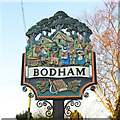
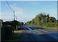
Bodham village sign
The sign depicts Bodham at its inception with Boda, after whom Bodham takes its name seemingly collecting his taxes from the peasants, in the form of a chicken (already at his feet) a pig, a goose, a lamb, some eggs, cheese and butter and a sheaf of wheat. Below the name are poppies, a thistle, ears of wheat, a reap hook with a forked stick and a bible.
Image: © Adrian S Pye
Taken: 17 Dec 2020
0.06 miles
5
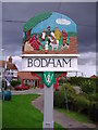
Bodham village sign
The Bodham village sign depicts a Tax collecter
Image: © Mark Hobbs
Taken: 6 Sep 2008
0.06 miles
6
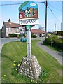
Village Sign
The village sign at Bodham, Norfolk. A plaque on the sign reads.... In commemoration of Queen Elizabeth II Silver Jubilee June 1977. Given by Bodham & District WI
Image: © Craig Tuck
Taken: 19 Apr 2009
0.06 miles
7
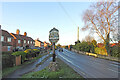
Bodham village sign
The sign depicts Bodham at its inception with Boda, after whom Bodham takes its name seemingly collecting his taxes from the peasants, in the form of a chicken (already at his feet) a pig, a goose, a lamb, some eggs, cheese and butter and a sheaf of wheat. Below the name are poppies, a thistle, ears of wheat, a reap hook with a forked stick and a bible.
Image: © Adrian S Pye
Taken: 17 Dec 2020
0.07 miles
8
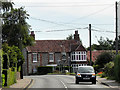
Bodham, The Street
The village of Bodham is situated on the A148 coast road which links the town of King’s Lynn to Cromer. It is approximately 27 miles north west of Norwich, 6½ miles west of Cromer and 3 miles south west of the nearest town, Sheringham. The civil parish had a population of 484 at the time of the 2011 Census.
Image: © David Dixon
Taken: 3 Aug 2015
0.07 miles
9
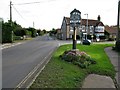
Bodham Village Sign
Also looking along the A148, King's Lynn to Cromer road in the direction of Cromer.
Image: © G Laird
Taken: 25 Oct 2017
0.07 miles