
IMAGES TAKEN NEAR TO
Ainsworth Road, HOLT, NR25 6LY
Introduction
This page details the photographs taken nearby to Ainsworth Road, NR25 6LY by members of the Geograph project.
The Geograph project started in 2005 with the aim of publishing, organising and preserving representative images for every square kilometre of Great Britain, Ireland and the Isle of Man.

There are currently over 7.5m images from over14,400 individuals and you can help contribute to the project by visiting https://www.geograph.org.uk
Image Map
Images are licensed for reuse under creativecommons.org/licenses/by-sa/2.0
Notes
- Clicking on the map will re-center to the selected point.
- The higher the marker number, the further away the image location is from the centre of the postcode.
Image Listing (26 Images Found)
Images are licensed for reuse under creativecommons.org/licenses/by-sa/2.0
Image
Details
Distance
1
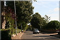
Holt: Cromer Road, "Holm Oaks" and Burrell Close
With my pockets stuffed with sweet chestnuts as I made my way from the station, I then noticed some unusual acorns on the ground under the dark green trees on the left. Then my eye was caught by a sign: "Holm Oaks B & B".
Having tried in vain to grow myself a Holm Oak in the past, I was scratting around looking for a good acorn or two when I was approached by the lady who lived there and wanted to know if I had lost something. When I explained she kindly pulled me a seedling out of a planter where she kept a collection of them, and I tucked it in my bag.
Image: © Chris
Taken: 1 Oct 2014
0.12 miles
3
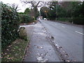
To Holt 3 And A Half Furlongs
Old milestone on the A.148 at Holt, Norfolk stating the distance not in miles but furlongs. For close up view see http://www.geograph.org.uk/photo/1639648
Image: © Keith Evans
Taken: 29 Dec 2009
0.14 miles
4
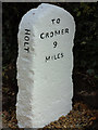
Old Milestone by Cromer Road, Holt Parish, North Norfolk
Carved stone post by the UC road, in parish of HOLT (NORTH NORFOLK District), North corner of junction with Laurel Drive, rear of pavement against hedge, on South side of road. Erected by an unknown authority in the 19th century. Photo from 2020 https://www.facebook.com/groups/TheNationalCycleNetwork/permalink/814739719310364/?app=fbl
Inscription reads:- : TO / HOLT / 3½ / FURLONGS : : HOLT : : TO / CROMER / 9 / MILES :
Milestone Society National ID: NO_CH09.
Image: © CW Haines
Taken: 23 May 2004
0.14 miles
5
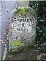
Old Milestone
Old milestone on the A.148 at Holt, Norfolk. For overall view see http://www.geograph.org.uk/photo/1639644
Image: © Keith Evans
Taken: 29 Dec 2009
0.15 miles
6
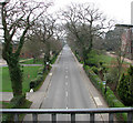
View west along Cromer Road
This view was taken from the footbridge > http://www.geograph.org.uk/photo/1250634 over Cromer Road, as it passes Gresham's School.
Image: © Evelyn Simak
Taken: 13 Apr 2009
0.16 miles
10
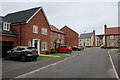
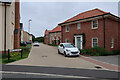
New housing near Holt
Part of a large area of housing on the edge of Holt. Fairly well served if you have a car, but a convuluted route into town by foot or bike (assuming you avoid the derestricted A-Road)
Image: © Hugh Venables
Taken: 30 Aug 2021
0.18 miles