
IMAGES TAKEN NEAR TO
Castle Road, HOLT, NR25 6LL
Introduction
This page details the photographs taken nearby to Castle Road, NR25 6LL by members of the Geograph project.
The Geograph project started in 2005 with the aim of publishing, organising and preserving representative images for every square kilometre of Great Britain, Ireland and the Isle of Man.

There are currently over 7.5m images from over14,400 individuals and you can help contribute to the project by visiting https://www.geograph.org.uk
Image Map
Images are licensed for reuse under creativecommons.org/licenses/by-sa/2.0
Notes
- Clicking on the map will re-center to the selected point.
- The higher the marker number, the further away the image location is from the centre of the postcode.
Image Listing (44 Images Found)
Images are licensed for reuse under creativecommons.org/licenses/by-sa/2.0
Image
Details
Distance
1

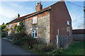
Line of cottages by road to Baconsthorpe Castle
Image: © Zorba the Geek
Taken: 3 Aug 2007
0.03 miles

3

Baconsthorpe
The main road through the small village of Baconsthorpe is called 'The Street'.
Image: © G Laird
Taken: 16 Jun 2014
0.12 miles


8

Brand-new gate and stile
On the public footpath which turns off The Street, leading to the ruined Baconsthorpe Castle > http://www.geograph.org.uk/photo/1121170 further to the north. Judging from the tracks, everybody appears to walk around it, squeezing through the gap between the gatepost and an adjoining drain.
Image: © Evelyn Simak
Taken: 15 Jan 2009
0.17 miles
9

Baconsthorpe Village Hall - detail
Detail on the south elevation of Baconsthorpe village hall > http://www.geograph.org.uk/photo/1121608 which marks it as a former National School, giving the date of its construction as 1816.
Image: © Evelyn Simak
Taken: 15 Jan 2009
0.18 miles
10

Baconsthorpe Village Hall
This view was taken across the junction of Church Lane (in foreground) and Plumstead Road, with School Lane seen beyond. The village hall is the smaller building seen at left. It once used to be a National School and was built in 1816 > http://www.geograph.org.uk/photo/1121609.
Image: © Evelyn Simak
Taken: 15 Jan 2009
0.18 miles