
IMAGES TAKEN NEAR TO
Woodlands Close, HOLT, NR25 6DU
Introduction
This page details the photographs taken nearby to Woodlands Close, NR25 6DU by members of the Geograph project.
The Geograph project started in 2005 with the aim of publishing, organising and preserving representative images for every square kilometre of Great Britain, Ireland and the Isle of Man.

There are currently over 7.5m images from over14,400 individuals and you can help contribute to the project by visiting https://www.geograph.org.uk
Image Map
Images are licensed for reuse under creativecommons.org/licenses/by-sa/2.0
Notes
- Clicking on the map will re-center to the selected point.
- The higher the marker number, the further away the image location is from the centre of the postcode.
Image Listing (31 Images Found)
Images are licensed for reuse under creativecommons.org/licenses/by-sa/2.0
Image
Details
Distance
1
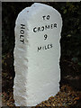
Old Milestone by Cromer Road, Holt Parish, North Norfolk
Carved stone post by the UC road, in parish of HOLT (NORTH NORFOLK District), North corner of junction with Laurel Drive, rear of pavement against hedge, on South side of road. Erected by an unknown authority in the 19th century. Photo from 2020 https://www.facebook.com/groups/TheNationalCycleNetwork/permalink/814739719310364/?app=fbl
Inscription reads:- : TO / HOLT / 3½ / FURLONGS : : HOLT : : TO / CROMER / 9 / MILES :
Milestone Society National ID: NO_CH09.
Image: © CW Haines
Taken: 23 May 2004
0.06 miles
2
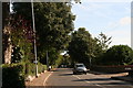
Holt: Cromer Road, "Holm Oaks" and Burrell Close
With my pockets stuffed with sweet chestnuts as I made my way from the station, I then noticed some unusual acorns on the ground under the dark green trees on the left. Then my eye was caught by a sign: "Holm Oaks B & B".
Having tried in vain to grow myself a Holm Oak in the past, I was scratting around looking for a good acorn or two when I was approached by the lady who lived there and wanted to know if I had lost something. When I explained she kindly pulled me a seedling out of a planter where she kept a collection of them, and I tucked it in my bag.
Image: © Chris
Taken: 1 Oct 2014
0.06 miles
3
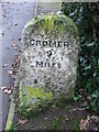
Old Milestone
Old milestone on the A.148 at Holt, Norfolk. For overall view see http://www.geograph.org.uk/photo/1639644
Image: © Keith Evans
Taken: 29 Dec 2009
0.06 miles
4
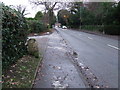
To Holt 3 And A Half Furlongs
Old milestone on the A.148 at Holt, Norfolk stating the distance not in miles but furlongs. For close up view see http://www.geograph.org.uk/photo/1639648
Image: © Keith Evans
Taken: 29 Dec 2009
0.06 miles
5
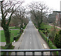
View west along Cromer Road
This view was taken from the footbridge > http://www.geograph.org.uk/photo/1250634 over Cromer Road, as it passes Gresham's School.
Image: © Evelyn Simak
Taken: 13 Apr 2009
0.08 miles
7
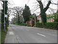
Bus stop on Cromer Road
This view was taken in westerly direction along Cromer Road as it passes Gresham's School. The bus stop is situated opposite Gresham's Senior Prep (seen at right).
Image: © Evelyn Simak
Taken: 13 Apr 2009
0.12 miles
8
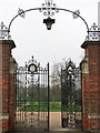
Ornate entrance gate
The wrought iron gate leads onto the grounds of Gresham's School > http://www.geograph.org.uk/photo/1250682. The school was founded in 1555 by Sir John Gresham, who converted Holt’s Manor House into a Free Grammar School as a result of Henry VIII’s suppression of the Monasteries. It survived the Great Fire of 1708 which destroyed most of medieval Holt and was extensively enlarged and refurbished in Victorian times. Renamed ‘Old School House’ it currently serves as home to the Pre-Prep School. At the turn of the twentieth century, Gresham’s was refounded under the direction of a new and innovative headmaster, George Howson and the School moved to the existing site. The Senior School and Prep School are presently located along both sides of Cromer Road on the eastern edge of Holt. There are four boarding houses for boys and three for girls and a wide range of buildings which include Big School, the School Chapel, the Auden Theatre, the Cairns Centre, the School Library, the Music Centre, the Central Block, the Thatched Classrooms, the Reith Laboratories, the Biology Building, the Armoury, and others. In September 2005, Gresham's was one of the leading British schools. http://www.greshams.com/history.php
Image: © Evelyn Simak
Taken: 13 Apr 2009
0.13 miles
9
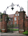
Entrance to Gresham's Senior Prep
The school was founded in 1555 by Sir John Gresham, who converted Holt’s Manor House into a Free Grammar School as a result of Henry VIII’s suppression of the Monasteries. It survived the Great Fire of 1708 which destroyed most of medieval Holt and was extensively enlarged and refurbished in Victorian times. Renamed ‘Old School House’ it currently serves as home to the Pre-Prep School. At the turn of the twentieth century, Gresham’s was refounded under the direction of a new and innovative headmaster, George Howson and the School moved to the existing site. The Senior School and Prep School are presently located along both sides of Cromer Road on the eastern edge of Holt. There are four boarding houses for boys and three for girls and a wide range of buildings which include Big School, the School Chapel, the Auden Theatre, the Cairns Centre, the School Library, the Music Centre, the Central Block, the Thatched Classrooms, the Reith Laboratories, the Biology Building, the Armoury, and others. In September 2005, Gresham's was one of the leading British schools. http://www.greshams.com/history.php
Image: © Evelyn Simak
Taken: 13 Apr 2009
0.13 miles
10
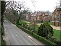
Gresham's Senior Prep
This view was taken from the footbridge > http://www.geograph.org.uk/photo/1250634 over Cromer Road which provides a safe crossing over Cromer Road for the pupils of Gresham's School, the buildings and playing fields of which are located on both sides of the road.
Image: © Evelyn Simak
Taken: 13 Apr 2009
0.15 miles