
IMAGES TAKEN NEAR TO
Dereham Road, NORWICH, NR2 4AY
Introduction
This page details the photographs taken nearby to Dereham Road, NR2 4AY by members of the Geograph project.
The Geograph project started in 2005 with the aim of publishing, organising and preserving representative images for every square kilometre of Great Britain, Ireland and the Isle of Man.

There are currently over 7.5m images from over14,400 individuals and you can help contribute to the project by visiting https://www.geograph.org.uk
Image Map
Images are licensed for reuse under creativecommons.org/licenses/by-sa/2.0
Notes
- Clicking on the map will re-center to the selected point.
- The higher the marker number, the further away the image location is from the centre of the postcode.
Image Listing (1132 Images Found)
Images are licensed for reuse under creativecommons.org/licenses/by-sa/2.0
Image
Details
Distance

2

View along Valentine Street
The street links Golding Place and Dereham Road.
Image: © Evelyn Simak
Taken: 11 Aug 2018
0.01 miles
3
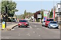
Coronavirus pandemic - 5th weekend of lockdown
Looking across Barn Road towards the traffic lights in Dereham Road it would seem that by the 5th weekend of the Coronavirus pandemic lockdown more cars had appeared on the roads of the city. More people also appear to be out and about on this sunny spring day.
Image: © Evelyn Simak
Taken: 26 Apr 2020
0.01 miles
4

St Benedicts View - Grapes Hill Community Garden
Work for creating this garden started in 2010, following a sketch by garden designer Laura Hall. The work was completed in January 2011. The garden contains a large number of edible plants, fruit trees and bushes as well as a great variety of herbs, vegetables and plants with edible flowers. The railings and gates surrounding it were constructed and installed by Rackham Engineering. Visitors are welcome to pick herbs and fruit from the garden, taking just a small share, however, and leaving some more for other people and wildlife.
Image: © Evelyn Simak
Taken: 11 Aug 2018
0.01 miles
5

10 Dereham Road - The Reindeer public house
For another view of this pub and some information see > http://www.geograph.org.uk/photo/5842015.
Image: © Evelyn Simak
Taken: 18 Sep 2018
0.01 miles
6

The Reindeer (pub sign)
For a view of this public house and some information see > http://www.geograph.org.uk/photo/5842015.
Image: © Evelyn Simak
Taken: 18 Sep 2018
0.01 miles
7

4-12 Valentine Street
This mid-19th century terrace of houses is Grade 2 listed.
Image: © Evelyn Simak
Taken: 11 Aug 2018
0.01 miles
8

9 Dereham Road - Majestic Wine Warehouse
Image: © Evelyn Simak
Taken: 18 Sep 2018
0.02 miles
9
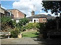
St Benedicts View - Grapes Hill Community Garden
Work for creating this garden started in 2010, following a sketch by garden designer Laura Hall. The work was completed in January 2011. The garden contains a large number of edible plants, fruit trees and bushes as well as a great variety of herbs, vegetables and plants with edible flowers. The railings and gates surrounding it were constructed and installed by Rackham Engineering. Visitors are welcome to pick herbs and fruit from the garden, taking just a small share, however, and leaving some more for other people and wildlife.
Image: © Evelyn Simak
Taken: 11 Aug 2018
0.02 miles
10

3-9 Valentine Street
This mid-19th century terrace of houses is Grade 2 listed.
Image: © Evelyn Simak
Taken: 11 Aug 2018
0.02 miles