
IMAGES TAKEN NEAR TO
Plumstead Road, MELTON CONSTABLE, NR24 2RN
Introduction
This page details the photographs taken nearby to Plumstead Road, NR24 2RN by members of the Geograph project.
The Geograph project started in 2005 with the aim of publishing, organising and preserving representative images for every square kilometre of Great Britain, Ireland and the Isle of Man.

There are currently over 7.5m images from over14,400 individuals and you can help contribute to the project by visiting https://www.geograph.org.uk
Image Map
Images are licensed for reuse under creativecommons.org/licenses/by-sa/2.0
Notes
- Clicking on the map will re-center to the selected point.
- The higher the marker number, the further away the image location is from the centre of the postcode.
Image Listing (57 Images Found)
Images are licensed for reuse under creativecommons.org/licenses/by-sa/2.0
Image
Details
Distance
1
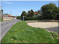
Right turn into Plumstead Road
Heads east from the village of Edgefield.
Image: © Pauline E
Taken: 7 May 2013
0.02 miles
2

The Pigs at Edgefield
Pub, restaurant and boutique hotel.
Image: © Pauline E
Taken: 7 May 2013
0.03 miles
4

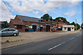
Speed limit 30mph
If only they did. Southern edge of the village near The Pigs.
Image: © Pauline E
Taken: 7 May 2013
0.04 miles
5
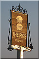
The Pigs at Edgefield
The pub stands at the southern edge of the village. Image
Image: © Pauline E
Taken: 6 May 2013
0.04 miles
6
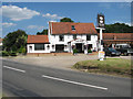
The Pigs, Edgefield
The inn was opened in 1789 and originally called "Three Pigs". It changed its name to "Piggs Inn" in 1826 and to "Pigs" in 1858. By 1861 it was known as "Frere Arms" and from 1952 onwards as "Bacon Arms" until its closure in March 1976. It was reopened as a freehouse under the name of "The Three Pigs" in April 1977.
The THREE PIGS Reopened 02.04.1977 as freehouse
Image: © Evelyn Simak
Taken: 1 Aug 2007
0.05 miles
7
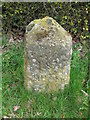
Old Milestone
Old milestone on the B1149 at Edgefield, Norfolk. For overall view see http://www.geograph.org.uk/photo/1816698
Image: © Keith Evans
Taken: 21 Apr 2010
0.06 miles
8
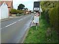
To Holt 3
Old milestone on the B1149 at Edgefield, Norfolk. For close up view see http://www.geograph.org.uk/photo/1816697
Image: © Keith Evans
Taken: 21 Apr 2010
0.06 miles
9
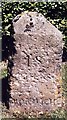
Old Milestone (west face) by the B1149, Norwich Road, Edgefield
Carved stone post by the B1149, in parish of EDGEFIELD (NORTH NORFOLK District), South of "Newlands", Norwich Road, next to road sign, on mown verge, on East side of road. Holt diamond, erected by an unknown authority in the 19th century.
Inscription reads:- : 18 / MILES / TO / NORWICH : : 3 / MILES / TO / HOLT :
Listed.
Milestone Society National ID: NO_NH18.
Image: © CW Haines
Taken: 18 May 2004
0.07 miles
10
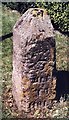
Old Milestone (south face) by the B1149, Norwich Road, Edgefield
Carved stone post by the B1149, in parish of EDGEFIELD (NORTH NORFOLK District), South of "Newlands", Norwich Road, next to road sign, on mown verge, on East side of road. Holt diamond, erected by an unknown authority in the 19th century.
Inscription reads:- : 18 / MILES / TO / NORWICH : : 3 / MILES / TO / HOLT :
Listed.
Milestone Society National ID: NO_NH18.
Image: © CW Haines
Taken: 18 May 2004
0.07 miles